Please login or click here to join.
Forgot Password? Click Here to reset pasword
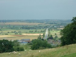
For centuries the countryside around Oakham has echoed to the sound of hunting horns, for the vales and rolling farmland surrounding this sedate market town, have been the stamping ground for the counties hunting fraternity...
An historic market town famous for its Pork packed pies and Stilton cheeses, both are savoured all over Britain and in many other countries...
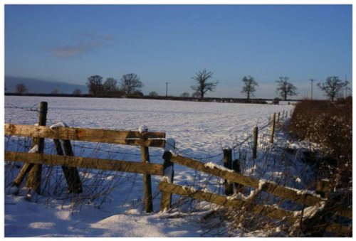
This is a quiet rural village situated in one of the highest parts of the rolling Leicestershire countryside...
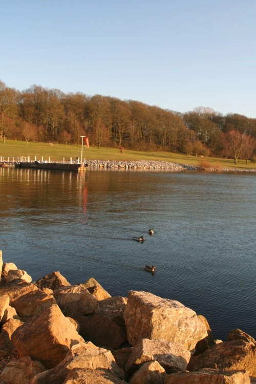
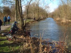
Normanton lies in a landscape of rolling farmlands, broken only by rivers and patches of woodland. It is a tranquil place, with the waters offering scope for sailing and other water-sports, bird-watching, fishing, and cycling...

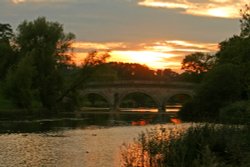
The village lies on the southern shores of Rutland Water, one of Europe's largest man-made reservoirs, and England's premier fly fishing waters...
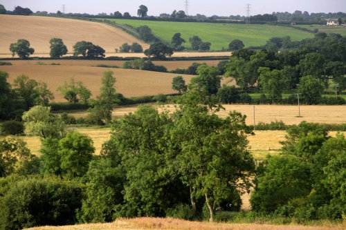
The tiny hamlet of Woolsthorpe-by-Colsterworth lies in spacious rural countryside in the valley of the River Witham...
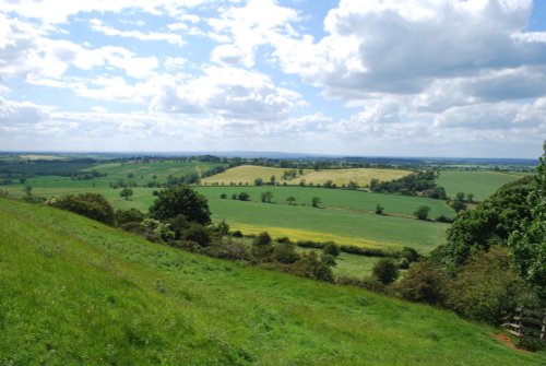
Bisbrooke lies amidst a landscape of gentle hills dotted with rolling farmlands, rivers, reservoirs and woodland...
Easter Monday sees the villages of Hallaton and Medbourne engaged in a riotous 'bottle kicking' contest which is said to have pagan origins...
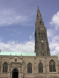
Of the 17 churches, only 6 now remain in Stamford, which is without doubt, one of the finest medieval towns in the British Isles, if not in Europe...
This delightful town, set on the River Witham in a spacious agricultural region is noted for many historic factors but more latterly as the birthplace of Britains first woman Primne Minister - Margaret Thatcher was born here in 1925 and she became Prime Minister in 1979...
Rothley is a delightful village with two village greens, one is flanked by some of the country's finest timber framed houses. The village shows a graceful selection of architecture including pretty Cruck Cottages...
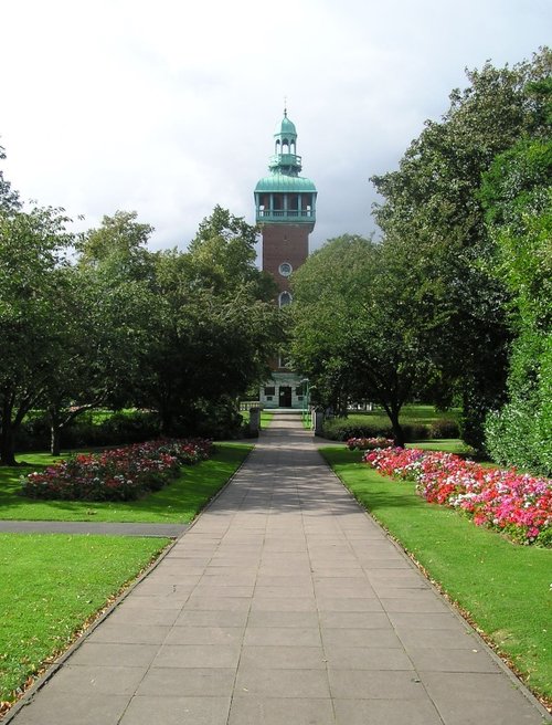
Leicester is famed amongst other things for its fine parish church which was raised to Cathedral status in 1927...
Quorn can be found between Leicester and Loughborough, it is surrounded by magnificent countryside and a wealth of visitor attractions...
..

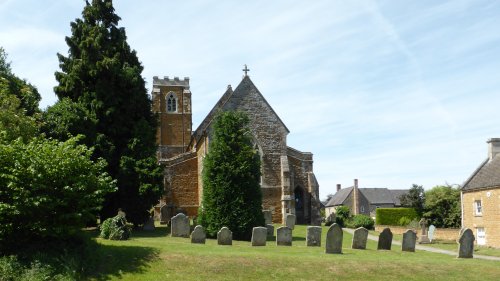
Apethorpe is a small, picturesque, East Northamptonshire village, a mile and a half from Kings Cliffe. St Leonard is an attractive looking church in a nice setting. Trees.....
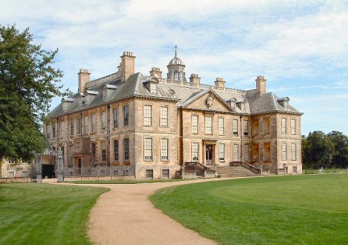
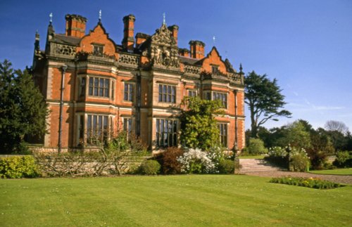
The popular village of Belton lying north of Grantham is home to magnificent Belton House. It is also a typical "Estate" village which perfectly epitomises all the values of English country life...
One of the most attractive features of Anstey is the famous 14th century five arched pack-horse bridge crossing the River Wreake...
The joyous sound of bells made in Loughborough have been rung all over the world since 1858, the date that John Taylor of Oxford moved his foundry to Loughborough. Many famous.....
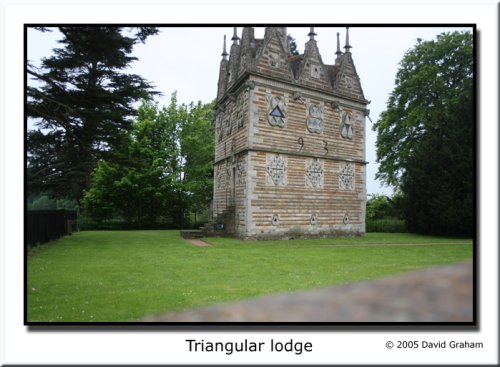
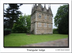
The picturesque village of Rushton set between Desborough and Rothwell is famous for the Rushton Triangular Lodge built in 1593 by Roman Catholic Sir Thomas Tresham to symbolise the Holy Trinity...
The lantern tower of the Church of St. Mary and All Saints at Fotheringhay shines through the deepening shadows of the great trees that frame it, shadows matched in darkness by those less visible that haunt the village where the final tragedy of Mary, Queen of Scots was enacted...
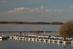
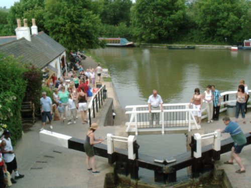
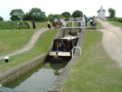
Rutland Water is the largest reservoir in England (by surface area) and one of the largest artificial lakes in Europe. Its.....
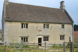
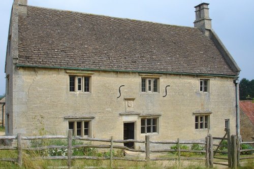
Called a manor but in reality this is the farmhouse where Isaac Newton was born in 1642. The house remains very much during.....
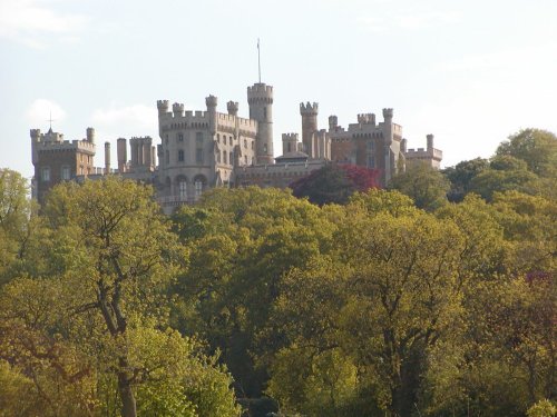
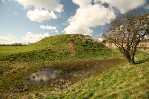
A castle has stood on this spot since the 11th-century, it was built by Robert de Todini, standard-bearer to William the.....
..
..
..
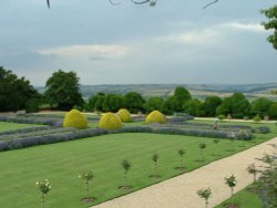
This is a graceful house which perfectly epitomises the wealth of the prosperous Elizabethan period. Burghley was completed in.....
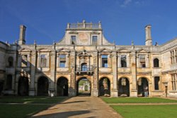
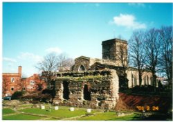
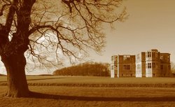
Looking around the romantic ruin of Kirby Hall it is easy to imagine the splendour of an age when romance was all, and great.....
..
..
This is Leicester's leading Museum of Archaeology, showing an extensive range Roman finds as well as other unique historic relics.....
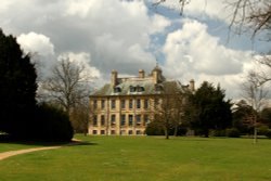
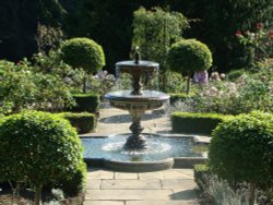
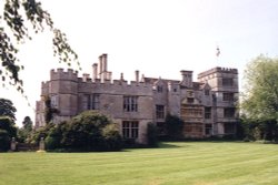
Belton is the perfect example of a home belonging to an English country gentleman, and yet it is a delightful Anglo-Dutch.....
..
..
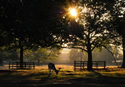
Comprising of 850 acres of land with roaming deer, Bradgate Park is Leicestershire's largest and most popular country.....
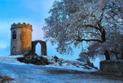
Standing on a hill overlooking Bradgate Park, Old John Tower folly.....
..
The second highest point in Leicestershire at 245m (802 feet) and containing a Bronze Age hill fort, Beacon Hill Country Park.....
This magnificent ruin is a rare romantic survival from the great Elizabethan period. The landscape on which the relic of this.....
..
Follow PicturesOfEngland.com on social media and help share the beauty of England....