Pictures of England

Search:

Historic Towns & Picturesque Villages

St. Michael & All Angels Church, Pinhoe near Exeter in Devon.

Pinhoe

in the county of Devon

River Trent, Beeston, Nottinghamshire.

Beeston

in the county of Nottinghamshire

Pictures of Bellingham

About Bellingham

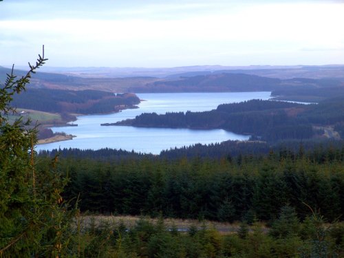
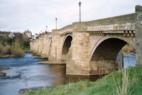
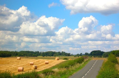
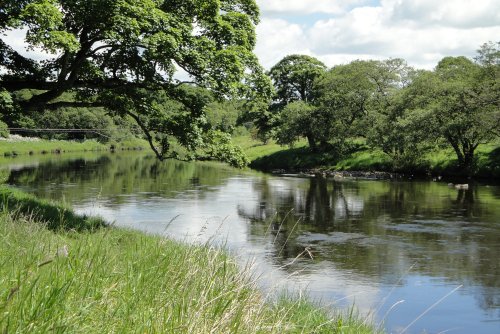
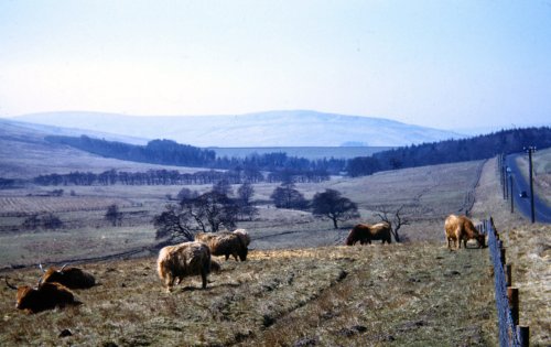
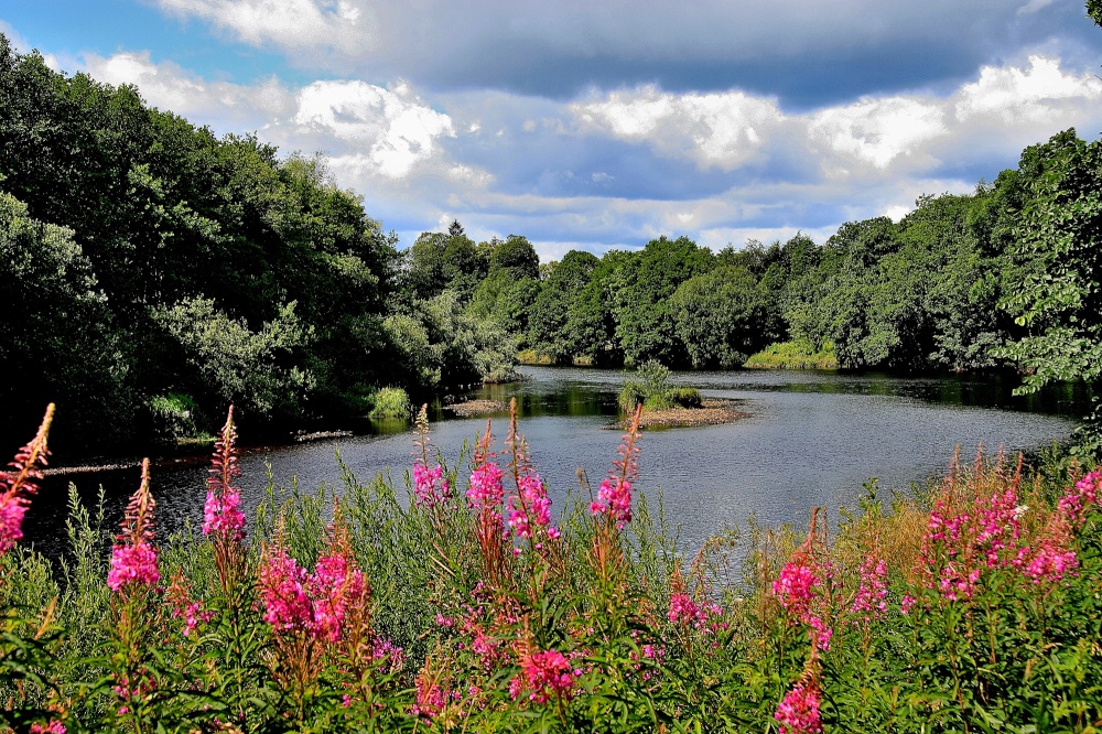
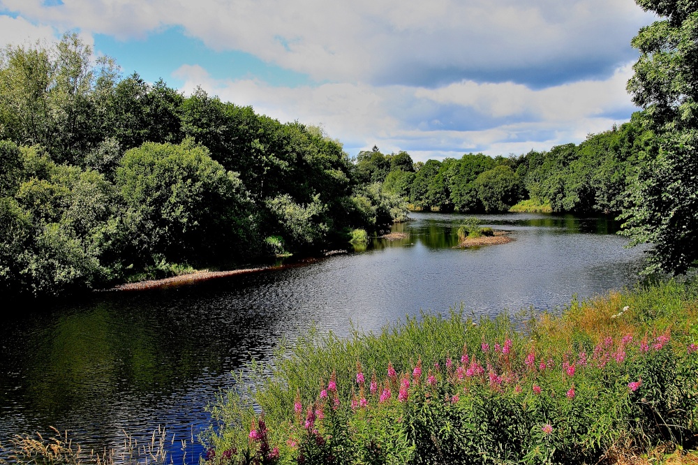
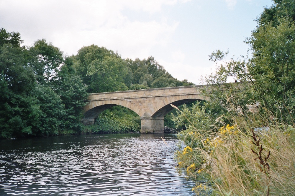
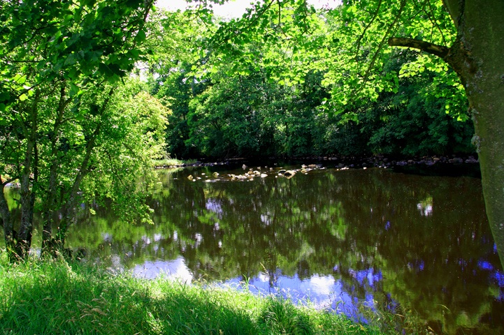
The market town of Bellingham sits on one of Northumberland's prettiest stretches of water, the north bank of the River North Tyne. This river runs through some of England's finest scenery as it follows its course below fells and across Forest Park where the waters are often shaded by wooded banks as it wends its way through rich grazing pastures. All around is quiet and tranquil, cattle graze and newborn lambs frollick. The beautiful stretch known as the Penine Way runs through south through Bellingham en route towards Hadrians Wall, it is in an area that is steeped in history dating back to the Bronze Age. This is evidenced by the finding of stone and bronze axes and a single burial cairn.

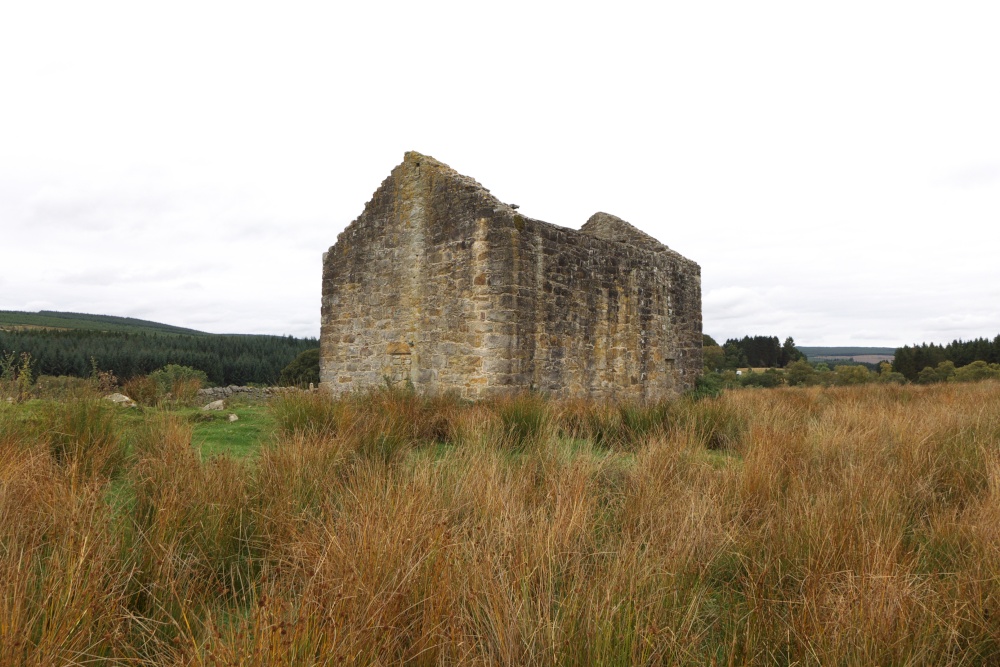
Evidence of occupation throughout the various historic periods have been documented and more is known of the Roman period than of Medieval times and following the Norman conquest, Bellingham was part of the medieval lordship of Tynedale.

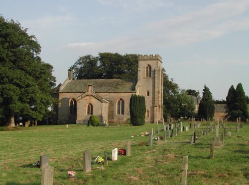
The troubles of the Border regions brought raids and skirmishes aplenty and the Men of Bellingham did their full share of raiding in this stormy period when attack from the north was an ever present threat. Legend has it that during one attack, villagers and cattle took shelter in St. Cuthberts church. The chancel of the church was twice burned down. Cannonballs, found lodged in the building are on display. However, the risk of fire is said to have ended when a rare type of roof was put on in the 17th-century. This consists of huge stone slabs resting on six sided arches; the walls were heavily buttressed to take the great weight of this unique structure and one cannot help but wonder at the strength of the men engaged in the building of this rare roof.

During the 17th-century and the early 18th-century a period of peace and prosperity came to the area and some fine buildings bear witness to this new found affluence, these include Lee Hall and Hesleyside Hall and Park.

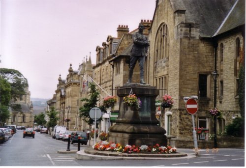
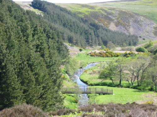
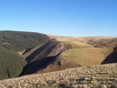
Today, Bellingham remains very much a market town at the heart of an agricultural area of peaceful farms and pastureland. There are long walks into the Border Park all of which start at Bellingham and reward the walker with excellent views of the surrounding countryside. One of the most spectacular sights is from a footpath that runs north alongside Hareshaw Burn. It passes the site of an old iron works, enters a wooded valley and goes on towards Hareshaw Linn. Here the land slides deeply down a sandstone outcrop and the whole vista is quite magical, especially after a rainfall when the air is fresh and sweet with the mingling scent of woods, grasses, wild flowers. The ironworks, founded in the 19th-century brought a spate of economic growth to the area only to be followed by a downturn when a decade or so later the works closed. Sad as this is, it is this closure that has led to the magical site we visit today. The naturalist would say - it was well worth it!

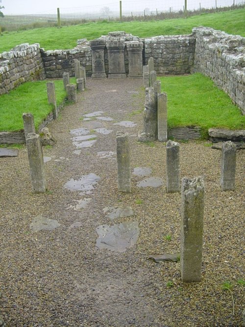
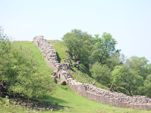
Other places of interest; Otterburn Mill lies a few miles further north and to the south is Hadrians Wall and the National Trust property of Housesteads Fort. Wherever you go, this is an area of wispering forests, rippling waters and high peaks, it is the English countryside at its very best.

Recommended towns & villages near Bellingham

St.Michael's Church in the village of WALL in the county of NORTHUMBERLAND - August 2003

Wall (1 Pictures) a Picturesque Village in the county of Northumberland

(10.2 miles, 16.5 km, direction SE of Bellingham)

The village of Wall lies in the high uplands of Northumberland in spacious countryside bordered by the rivers South Tyne and North Tyne, close to Chester's Fort on historic Hadrian's Wall...

A view of Hexham in Northumberland. Fog over the River Tyne.

Hexham (35 Pictures) a Historic Market Town in the county of Northumberland

(13.2 miles, 21.3 km, direction SE of Bellingham)

Historic market town where for centuries the sheep and cattle farmers of Northumberland gathered for the Tuesday market beside Hexham Abbey...

A picture of Kielder Water

Kielder (57 Pictures) in the county of Northumberland

(14.7 miles, 23.6 km, direction NW of Bellingham)

This small historic village lies at the northernmost edge of Kielder Water, it takes its name from the Kielder Burn the stream that links with the Deadwater Burn to form the North Tyne River...

Corbridge, Northumberland

Corbridge (31 Pictures) a Picturesque Village in the county of Northumberland

(15.1 miles, 24.4 km, direction SE of Bellingham)

Located in Northumberland, Corbridge is a historic market town with Roman connections. It features charming streets, historic buildings, and the Corbridge Roman Town archaeological site...

Near Bolam in Northumberland.

Bolam (3 Pictures) a Picturesque Village in the county of Northumberland

(15.4 miles, 24.8 km, direction E of Bellingham)

This is an historic village, it took its name from a Baron de Bolam in the 13th century...

All towns & villages in Northumberland
Complete A to Z of towns & villages in England

Nearby attractions..

Mithraeum temple near Brocolitia roman fort Milecastle

Carrawburgh Roman Fort (Brocolitia) (2 Pictures)

(8.1 miles, 13.0 km, direction S)

..

The River North Tyne

Chesters Roman Fort (Cilvrnvm) (71 Pictures)

(9.4 miles, 15.0 km, direction SE)

..

A Walk in the Cheviots, Northumberland

Northumberland National Park (63 Pictures)

(9.4 miles, 15.2 km, direction N)

The Northumberland National Park is surely Northumberland's special blessing. It is an area of wild, desolate moorland and dark,.....

Hadrian's Wall

Hadrian's Wall & Housesteads Fort (36 Pictures)

(9.6 miles, 15.5 km, direction S)

Wild and evocative remains of the Roman Empire's most northerly defences, with panoramic views. Roman barracks and some of the.....

A picture of Kielder Water

Kielder Water (27 Pictures)

(9.7 miles, 15.7 km, direction W)

..

Ravens Crag and the Allerhope Burn, The Cheviot Hills, Northumberland.

The Cheviot Hills (12 Pictures)

(9.9 miles, 16.0 km, direction N)

The clearly defined peaks of the glorious Cheviot Hills dominate the western side of the border territory as it juts boldly out.....

A picture of Redesdale

Redesdale (1 Pictures)

(10.0 miles, 16.0 km, direction N)

..


All attractions in Bellingham
All attractions in Northumberland
Complete A to Z of attractions in England