Pictures of England

Search:

Historic Towns & Picturesque Villages

Castle Rising Castle

Castle Rising

in the county of Norfolk

Barrow from Sandscale Hawes in Early January

Barrow in Furness

in the county of Cumbria

Recommended Towns & Villages near Wooldale

Holmfirth, West Yorkshire

Holmfirth (40 Pictures)

in the county of West Yorkshire (0.7 miles, 1.1 km)

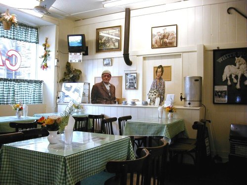
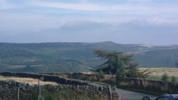
This is a place that will forever be associated with the gentle, romantic comedy "Last of the Summer Wine" which has graced our TV screens for more than a quarter of a century...

ALMONDBURY CONSERVATIVE CLUB, ALMONDBURY, HUDDERSFIELD, WEST YORKSHIRE

Almondbury (6 Pictures)

a Picturesque Village in the county of West Yorkshire (3.4 miles, 5.5 km, direction N)

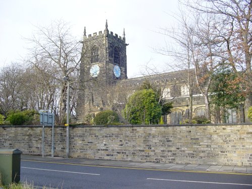
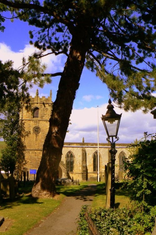
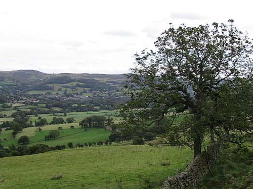
Almondbury is one of the oldest and prettiest of the villages dominating the edge of the Pennine moors...

A picture of Huddersfield

Huddersfield (98 Pictures)

in the county of West Yorkshire (4.6 miles, 7.4 km, direction N)

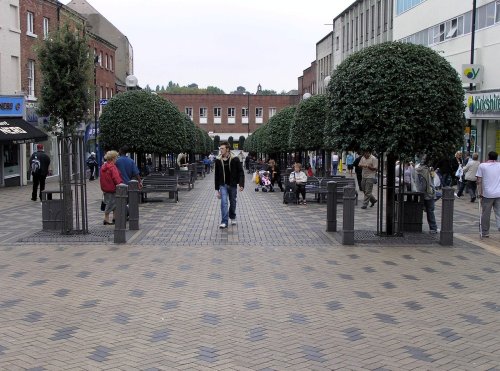
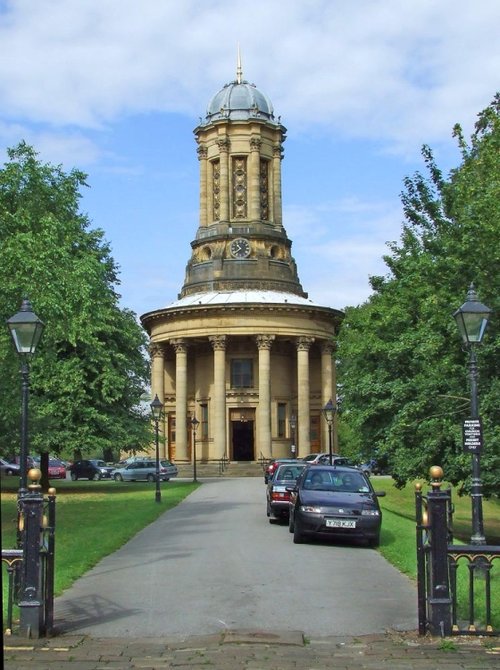
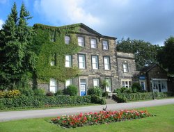
Huddersfield is a lively and interesting town that offers a rich cultural experience...

Mill Fold, Golcar, West Yorkshire

Golcar (2 Pictures)

in the county of West Yorkshire (4.9 miles, 7.9 km, direction NW)

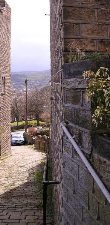
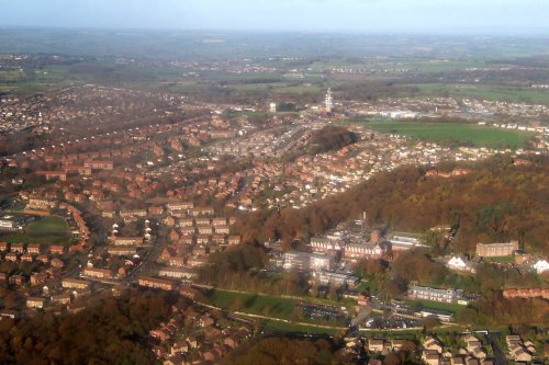
Sturdily built of stone, this small hill town is perched north of the River Colne and the now restored Huddersfield Narrow Canal...

Standedge Tunnel, Marsden

Marsden (33 Pictures)

in the county of West Yorkshire (6.5 miles, 10.4 km, direction W)

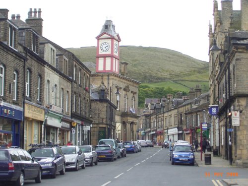
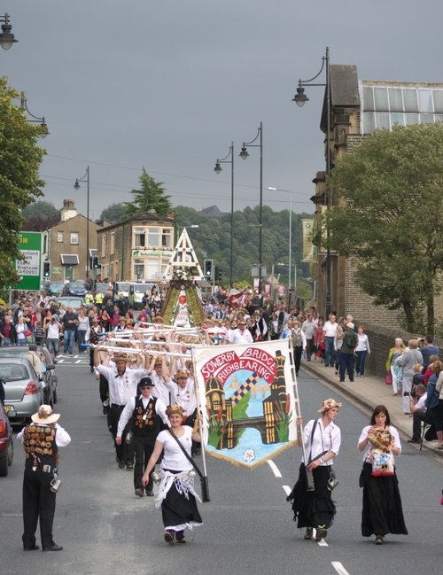
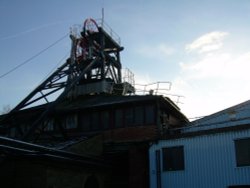
Marsden offers visitors a wealth of heritage, particularly in association with the town's expansion which came about during the heady days of the Industrial Revolution...

Mirfield (west yorkshire), showing the mirfield church (st mary's)

Mirfield (8 Pictures)

in the county of West Yorkshire (7.7 miles, 12.3 km, direction NE)

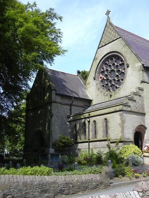
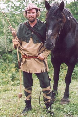
Mirfield is a residential town situated between Huddersfield and Dewsbury. It has a long history, and associations with Robin Hood, the Luddites, and the Bronte sisters. More.....

Sowerby bridge basin, West Yorkshire.

Sowerby Bridge (11 Pictures)

in the county of West Yorkshire (10.4 miles, 16.8 km, direction NW)

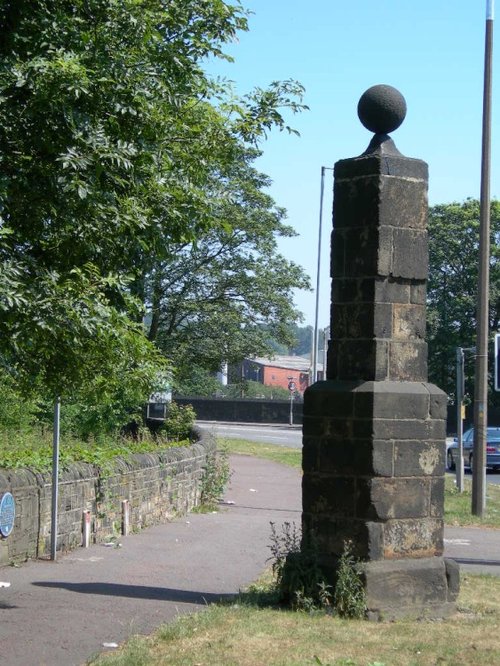
Surrounded by the dramatic scenery of the South Pennines, with the town's gentle scenery being enhanced by the River Calder and the River Ryburn on which the town stands...

Town of Halifax

Halifax (83 Pictures)

in the county of West Yorkshire (10.7 miles, 17.2 km, direction N)

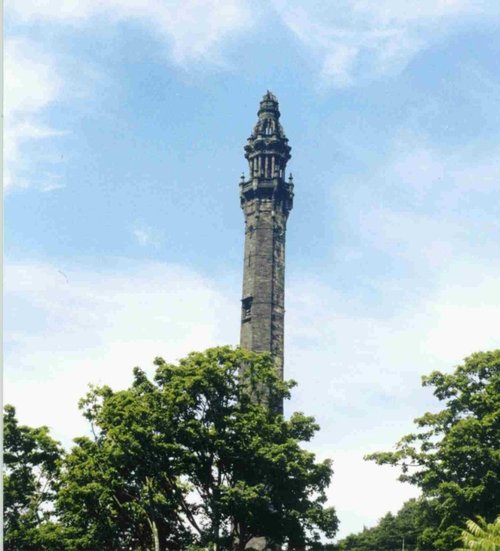
Halifax is an industrial city close to the famous Pennines and the route of the Pennine Way in what is known as Yorkshire's "Bronte" country...

Monk BrettonPpriory in winter

Barnsley (159 Pictures)

in the county of South Yorkshire (12.4 miles, 19.9 km, direction E)

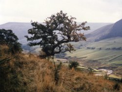
This is an attractive town laid out along the River Dearne, it is enclosed by spectacular Pennine scenery and is an ideal place from which to discover the limestone hills and fresh green valley's of the Yorkshire Dales...

Dawn in Secker Wood

Wakefield (43 Pictures)

in the county of West Yorkshire (13.2 miles, 21.3 km, direction NE)

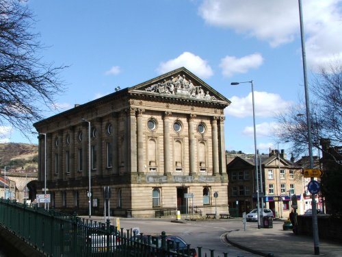
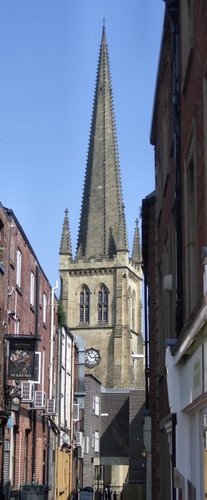
Wakefield was the capital of Yorkshire's woollen industry for more than 700 years, it was an important weaving and dying centre as far back as the 13th century...

centre 03

Hebden Bridge (43 Pictures)

a Historic Market Town in the county of West Yorkshire (14.9 miles, 24.0 km, direction NW)

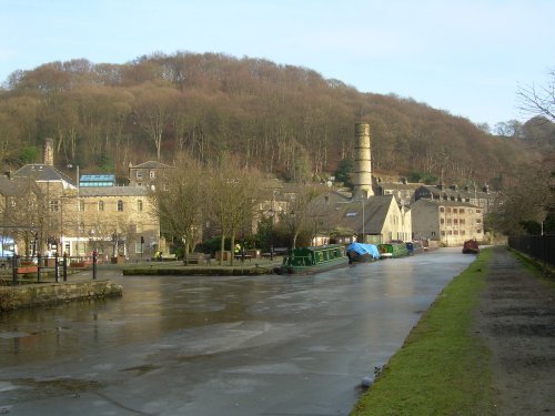
This beautiful old town grew up close to the River Hebden at the point where a stone bridge was built as part of a pack-horse route in the 16th century...

This is St Stephens Church, which is in Audenshaw.

Audenshaw (2 Pictures)

in the county of Greater Manchester (16.1 miles, 26.0 km, direction SW)

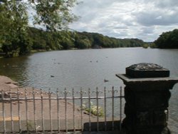
Audenshaw is a suburb of Greater Manchester. It is probably best known for its reservoirs and the busy waters of the Ashton canal, beside which visitors can see clusters of delightful canal-side properties...

A picture of Todmorden

Todmorden (12 Pictures)

in the county of West Yorkshire (16.3 miles, 26.2 km, direction NW)

Todmorden lies on the historic border between Yorkshire and Lancashire in an area of the Calder Valley ringed by the hills of the Pennines...

Mam Tor

Castleton (217 Pictures)

a Picturesque Village in the county of Derbyshire (16.3 miles, 26.3 km, direction S)

Castleton is one of the Jewels of the Peak District. It is a famous centre for caverns where you will find four of the countries most famous show caves. It is also the home of.....

Lock gate, Marple canal

Marple (24 Pictures)

in the county of Greater Manchester (17.2 miles, 27.8 km, direction SW)

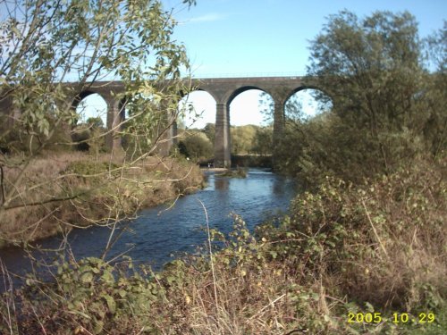
Marple has many splendid canal features from the past, these include a flight of 16 locks and a three arched aqueduct which takes the Peak Forest canal over the River Goyt...

United Reformed Church at Saltaire, West Yorkshire.

Saltaire (54 Pictures)

a Picturesque Village in the county of West Yorkshire (17.8 miles, 28.6 km, direction N)

This perfectly preserved village originated as an answer to Bradford's 'dark satanic mills', it was the brain-child of industrialist Sir Titus Salt, who in the early 19th-century.....

Corn Exchange in Leeds, West Yorkshire

Leeds (233 Pictures)

in the county of West Yorkshire (17.9 miles, 28.9 km, direction NE)

In the middle ages Leeds was a wool centre and it flourished. The sheep on the Yorkshire moors providing the wool for the cottage craft industry of spinning and weaving. The.....

Hathersage Church. Derbyshire.

Hathersage (59 Pictures)

a Picturesque Village in the county of Derbyshire (18.0 miles, 28.9 km, direction S)

The town now takes advantage of its superb position, operating mostly as an attractive place for tourists...

A view of Castle Nase taken from the edge of Coombs Reservoir, Chapel-en-le-Frith, Derbyshire

Chapel-en-le-Frith (5 Pictures)

in the county of Derbyshire (18.4 miles, 29.6 km, direction S)

Chapel is a well preserved, picturesque place. It has a lovely old church dating back to the 14th-century which stands on the spot of an earlier church built by foresters a century or so before...

Reddish Vale Viaduct, Reddish near Stockport

Reddish (37 Pictures)

in the county of Greater Manchester (18.4 miles, 29.7 km, direction SW)

This is a densely populated area of Stockport, Greater Manchester. It is fortunate to be close to the edge of Cheshire, thus residents have the benefit of being within easy reach of some attractive countryside...

Recommended attractions near Wooldale

Marsden Moor, Yorkshire

Marsden Moor Estate (2 Pictures)

(6.5 miles, 10.5 km, direction W)

Marsden Moor was gifted to the National Trust in 1955 by Captain Sir Joseph Benedict Everard Henry Radcliffe in lieu of death.....

Cannon Hall park

Cannon Hall Country Park (24 Pictures)

(7.7 miles, 12.3 km, direction E)

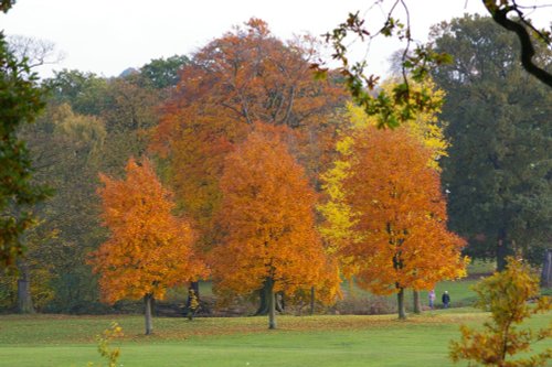
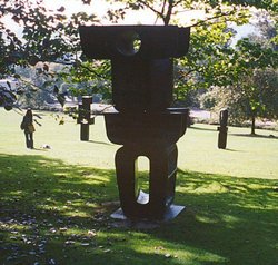
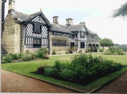
Outstanding country park originally landscaped in the 1760's by Richard Woods. The park surrounds a magnificent hall designed by.....

Pit head gear at Caphouse Colliery

National Coal Mining Museum (33 Pictures)

(7.7 miles, 12.4 km, direction NE)

..

Robin Hoods Grave, Kirklees Priory, West Yorkshire

Robin Hood's Grave (4 Pictures)

(7.7 miles, 12.4 km, direction N)

..

Kirklees Priory Gatehouse, West Yorkshire

Kirklees Priory (2 Pictures)

(8.0 miles, 13.0 km, direction N)

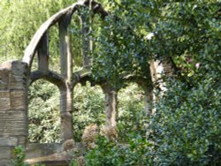
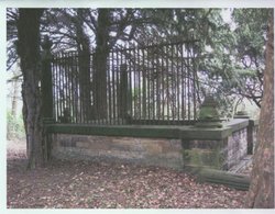
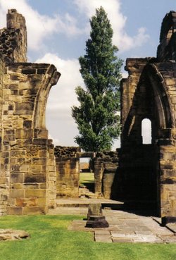
Home of the wicked Prioress who bled the unsuspecting Robin Hood to death. All that remains today is the Priory Gatehouse and.....

Yorkshire Sculpture Park, West Bretton, West Yorkshire

Yorkshire Sculpture Park (35 Pictures)

(8.8 miles, 14.2 km, direction E)

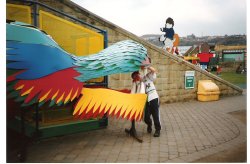
This is an exciting, fascinating tourist attraction that is both fun and thought provoking for all the family. It has fast.....

Dewsbury Museum in Crow Nest Park, Dewsbury, West Yorkshire.

Dewsbury Museum (1 Pictures)

(9.2 miles, 14.8 km, direction NE)

..

Eureka Science Museum  - Yorkshire - 1996

Eureka! Museum for Children (3 Pictures)

(10.1 miles, 16.3 km, direction N)

..

Shibden Hall, Halifax, West Yorkshire

Shibden Hall (36 Pictures)

(10.4 miles, 16.8 km, direction N)

..

A good view of Stainborough Castle at Wentworth Castle Gardens near Barnsley

Wentworth Castle (50 Pictures)

(11.3 miles, 18.2 km, direction E)

Wentworth Castle Gardens have been the subject of an ambitious plan to restore the magnificent estate, once home to the Earls of.....

Robin Hood

Bradfield Moors (3 Pictures)

(11.7 miles, 18.9 km, direction SE)

..

A view of Newmillerdam taken near the memorial, West Yorkshire.

Newmillerdam Country Park (20 Pictures)

(12.1 miles, 19.5 km, direction E)

This attractive country park offers a rich and varied country landscape, it is dominated by a large lake ringed by numerous trees.....

Alport Dale, Hope Forest, Derbyshire (Peak District National Park)

Alport Castles (3 Pictures)

(12.4 miles, 19.9 km, direction S)

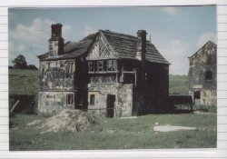
Alport Castles refers to a striking natural feature in the Peak District National Park, Derbyshire, England. Despite its name,.....

Outline of Sandal

Sandal Castle (12 Pictures)

(12.9 miles, 20.8 km, direction NE)

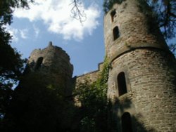
The crumbling, naked ruins of Sandal Castle are now owned by Wakefield council, and what an inspired choice of centre-piece they.....

Wakefield Cathedral, West Yorkshire. Viewed from Westgate

Wakefield Cathedral (2 Pictures)

(13.4 miles, 21.6 km, direction NE)

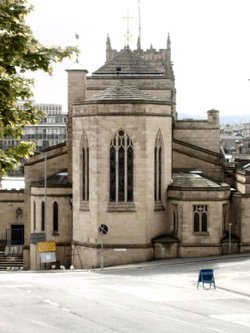
This was formerly the parish church of All Saints, it only became a cathedral at the end of the 19th century. With its.....

at Monk Bretton Priory, Cudworth, South Yorkshire

Monk Bretton Priory (8 Pictures)

(14.3 miles, 23.0 km, direction E)

..

Ladybower Reservoir, Derbyshire. October 2004

Ladybower Reservoir (108 Pictures)

(14.3 miles, 23.0 km, direction S)

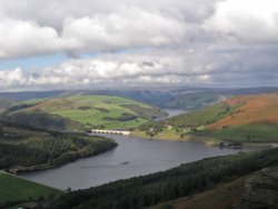
This beautiful reservoir is found in the undulating Derbyshire countryside. It is the lowest of the Peak districts three.....

National Museum of Photography, Film and TV. Bradford.

National Museum of Photography, Film & Television (3 Pictures)

(14.6 miles, 23.5 km, direction N)

..

Bradford Cathedral, West Yorkshire

Bradford Cathedral (3 Pictures)

(15.2 miles, 24.5 km, direction N)

..

Towards Stanage on an Autumn day

Stanage Edge (26 Pictures)

(15.9 miles, 25.5 km, direction S)

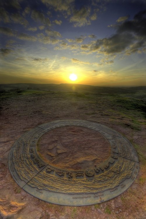
Stanage Edge is an elevated gritstone edge or enscarpment that stretches for around 4 miles giving extensive views across the.....


All attractions in Wooldale
All attractions in West Yorkshire