Pictures of England

Search:

Historic Towns & Picturesque Villages

Ely Cambridgeshire

Ely

a Historic City in the county of Cambridgeshire

Brightlingsea

Brightlingsea

a Seaside Town in the county of Essex

The Boat and House

Wroxham

in the county of Norfolk

Recommended Towns & Villages near Thurmaston

Rothley Railway Station

Rothley (12 Pictures)

in the county of Leicestershire (2.9 miles, 4.7 km, direction NW)

Rothley is a delightful village with two village greens, one is flanked by some of the country's finest timber framed houses. The village shows a graceful selection of architecture including pretty Cruck Cottages...

Saint Mary De Castro Church and Churchyard, Leicester

Leicester (362 Pictures)

a Historic City in the county of Leicestershire (3.1 miles, 5.0 km, direction SW)

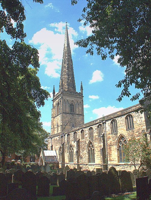
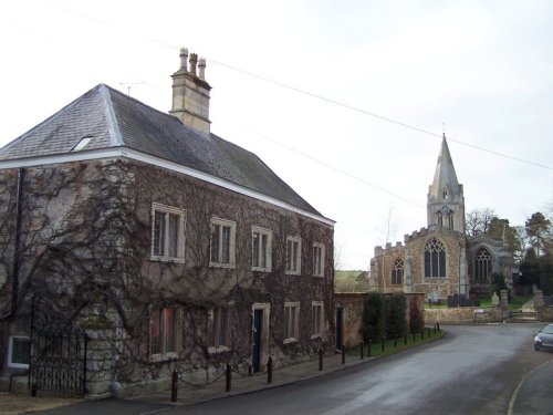
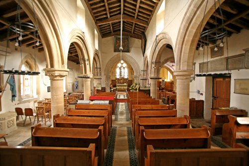
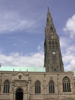
Leicester is famed amongst other things for its fine parish church which was raised to Cathedral status in 1927...

Groby Road, Anstey, Leicester

Anstey (5 Pictures)

in the county of Leicestershire (4.1 miles, 6.6 km, direction W)

One of the most attractive features of Anstey is the famous 14th century five arched pack-horse bridge crossing the River Wreake...

A picture of Quorn

Quorn (18 Pictures)

in the county of Leicestershire (5.6 miles, 8.9 km, direction NW)

Quorn can be found between Leicester and Loughborough, it is surrounded by magnificent countryside and a wealth of visitor attractions...

Town Hall in Loughborough, Leicestershire

Loughborough (74 Pictures)

in the county of Leicestershire (8.1 miles, 13.1 km, direction NW)

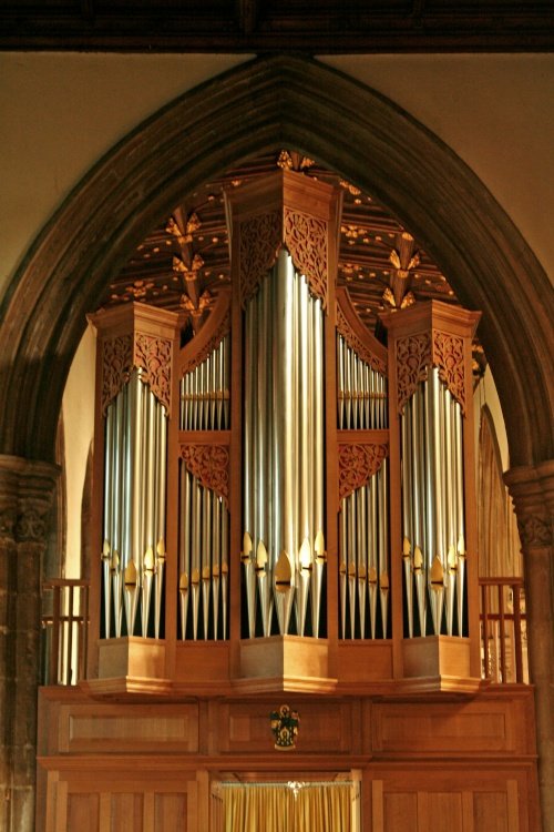
The joyous sound of bells made in Loughborough have been rung all over the world since 1858, the date that John Taylor of Oxford moved his foundry to Loughborough. Many famous.....

The fine old church at Tilton-on-the-Hill, Leicestershire

Tilton on the Hill (4 Pictures)

in the county of Leicestershire (8.4 miles, 13.5 km, direction E)

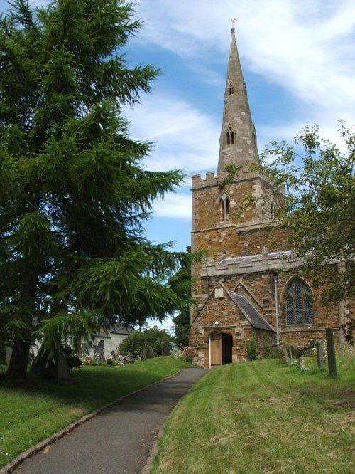
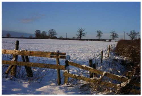
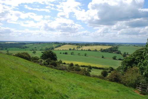
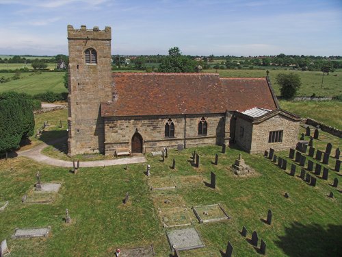
This is a quiet rural village situated in one of the highest parts of the rolling Leicestershire countryside...

The view from Burrough Hill

Melton Mowbray (25 Pictures)

a Historic Market Town in the county of Leicestershire (10.7 miles, 17.2 km, direction NE)

An historic market town famous for its Pork packed pies and Stilton cheeses, both are savoured all over Britain and in many other countries...

Taken in the Hall Yard Park looking towards St Simon & St Judes Parish Church, Earl Shilton

Earl Shilton (1 Pictures)

in the county of Leicestershire (11.9 miles, 19.2 km, direction SW)

Earl Shilton is one of the largest villages in the County of Leicestershire. It occupies a rich rural landscape between the town of Hinckley and the City of Leicester...

Foxton Locks

Foxton (21 Pictures)

a Picturesque Village in the county of Leicestershire (12.7 miles, 20.5 km, direction SE)

..

Hallaton, Leicestershire

Hallaton (18 Pictures)

in the county of Leicestershire (13.5 miles, 21.7 km, direction SE)

Easter Monday sees the villages of Hallaton and Medbourne engaged in a riotous 'bottle kicking' contest which is said to have pagan origins...

Oakham Castle and All Saints Church

Oakham (86 Pictures)

in the county of Rutland (15.1 miles, 24.3 km, direction E)

For centuries the countryside around Oakham has echoed to the sound of hunting horns, for the vales and rolling farmland surrounding this sedate market town, have been the stamping ground for the counties hunting fraternity...

Staunton Harold Reservoir

Staunton Harold (22 Pictures)

in the county of Leicestershire (16.5 miles, 26.6 km, direction NW)

Staunton was mentioned in the Doomsday Book when it was held by Henry de Ferrers...

View from the tower Ashby de la Zouch Castle, Leicestershire

Ashby de la Zouch (41 Pictures)

a Historic Market Town in the county of Leicestershire (16.6 miles, 26.7 km, direction W)

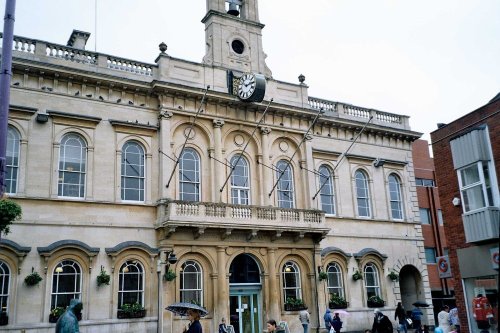
This town takes its name from the La Souche family, lords of the manor from about 1160. The Norman prefix distinguishes Ashby from other towns of similar name...

Boating on the River Trent near Trent Lock, Long Eaton, Derbyshire

Long Eaton (98 Pictures)

in the county of Derbyshire (17.1 miles, 27.5 km, direction NW)

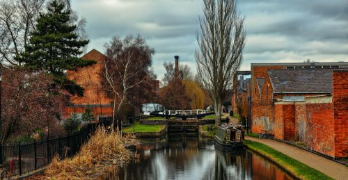
Long Eaton is a small town lying on the River Trent around 8 miles east of Derby. The town has a history stretching back to the 7th century, but was for many centuries naught but a sleepy agricultural village...

Bisbrooke Church, Rutland - Completely re-built 1871. Tower built 1914. Grade II listed.

Bisbrooke (3 Pictures)

a Picturesque Village in the county of Rutland (17.8 miles, 28.7 km, direction E)

Bisbrooke lies amidst a landscape of gentle hills dotted with rolling farmlands, rivers, reservoirs and woodland...

River Trent, Beeston, Nottinghamshire.

Beeston (270 Pictures)

in the county of Nottinghamshire (17.9 miles, 28.8 km, direction N)

Beeston is mostly remarkable for being the place where the Ist Lord Trent started work in his mother's herbal shop at the age of 14...

A picture of Stanford on Avon

Stanford on Avon (8 Pictures)

in the county of Northamptonshire (18.9 miles, 30.4 km, direction S)

Picturesque village straddling the banks of the River Avon...

Market square, Nottingham

Nottingham (210 Pictures)

a Historic City in the county of Nottinghamshire (19.5 miles, 31.4 km, direction N)

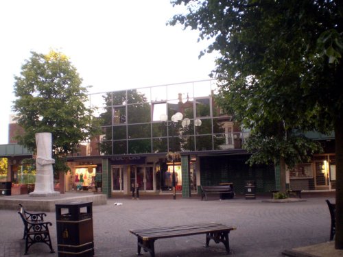
The City of Nottingham is famed for fine lace, the romance of Maid Marion and Robin Hood and as the birthplace of the founder of the Salvation Army, General William Booth (1829-1912)...

The Church of St James in the village of Swarkestone, Derbyshire.

Swarkestone (9 Pictures)

in the county of Derbyshire (19.6 miles, 31.5 km, direction NW)

Swarkestone is a small enchanting village which grew up on the reeeded banks of the River Trent...

The village of Edith Weston, Rutland

Edith Weston (13 Pictures)

in the county of Rutland (19.7 miles, 31.7 km, direction E)

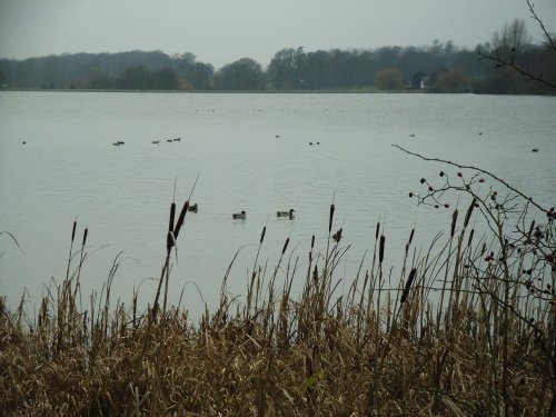
The village lies on the southern shores of Rutland Water, one of Europe's largest man-made reservoirs, and England's premier fly fishing waters...

Recommended attractions near Thurmaston

A picture of Watermead Country Park

Watermead Country Park (174 Pictures)

(0.9 miles, 1.5 km)

..

Leicester Cathedral, Leicester

Leicester Cathedral (16 Pictures)

(3.2 miles, 5.1 km, direction SW)

..

Jewry Wall, A small piece of the Roman Wall still remains in Leicester City Centre.

The Jewry Wall Museum (15 Pictures)

(3.5 miles, 5.6 km, direction SW)

This is Leicester's leading Museum of Archaeology, showing an extensive range Roman finds as well as other unique historic relics.....

Bradgate Park, Leicester, leicestershire

Bradgate Park (257 Pictures)

(4.9 miles, 7.8 km, direction W)

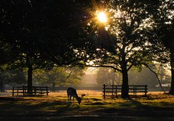
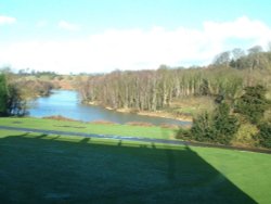
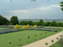
Comprising of 850 acres of land with roaming deer, Bradgate Park is Leicestershire's largest and most popular country.....

Old John, Bradgate Park, Leicestershire

Old John Tower (10 Pictures)

(5.7 miles, 9.2 km, direction W)

Standing on a hill overlooking Bradgate Park, Old John Tower folly.....

The Old Man of Beacon, Beacon Hill Country Park, Leicestershire

Beacon Hill Country Park (24 Pictures)

(7.4 miles, 11.9 km, direction NW)

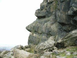
The second highest point in Leicestershire at 245m (802 feet) and containing a Bronze Age hill fort, Beacon Hill Country Park.....

Letting off Steam on the Great Central Railway

Great Central Railway (48 Pictures)

(7.8 miles, 12.6 km, direction NW)

..

Thornton Reservoir, Leicestershire.

Thornton Reservoir (13 Pictures)

(8.9 miles, 14.4 km, direction W)

..

Foxton Locks, Near Market Harborough, 'Narrow Boat coming down'

Foxton Locks (37 Pictures)

(12.9 miles, 20.8 km, direction S)

..

Staunton harold hall & Church, Leicestershire

Staunton Harold Church (6 Pictures)

(15.6 miles, 25.1 km, direction NW)

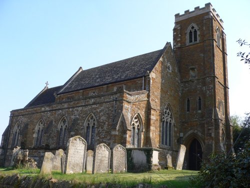
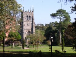
Imposing church built in 1653, with fine panelled interior, set in attractive parkland...

Le Mans Series racers at the Melbourne Hairpin, Donington Park Circuit, Derbyshire

Donington Park (11 Pictures)

(16.0 miles, 25.7 km, direction NW)

..

View from the tower Ashby de la Zouch Castle, Leicestershire

Ashby de la Zouch Castle (28 Pictures)

(16.2 miles, 26.0 km, direction W)

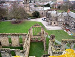
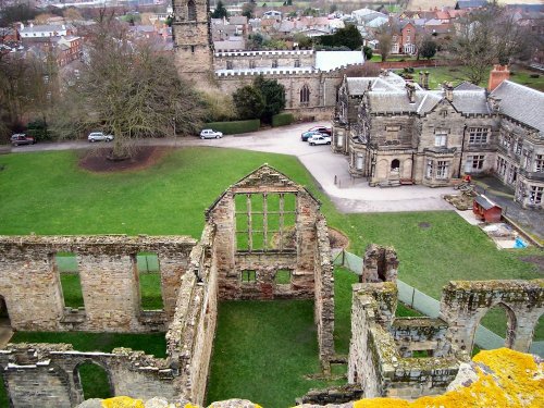
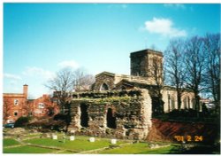
The ancient, crumbling walls of Ashby de la Zouch castle keep once rose to a towering 95ft and had four floors. It belonged to.....

Staunton Harold Church

Staunton Harold Hall (14 Pictures)

(16.4 miles, 26.4 km, direction NW)

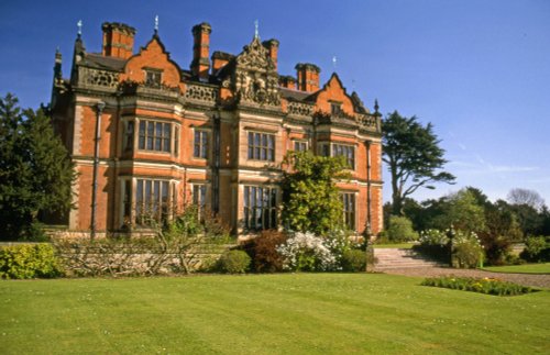
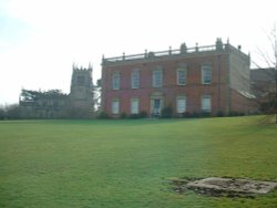
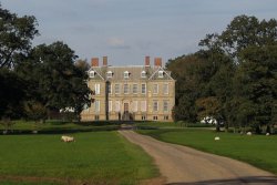
This is said to be one of the most delightful country houses in Leicestershire, it was the former home of the Ferrers family who.....

Rutland Water

Rutland Water (128 Pictures)

(16.8 miles, 27.0 km, direction E)

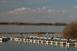
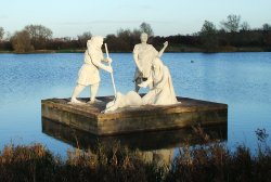
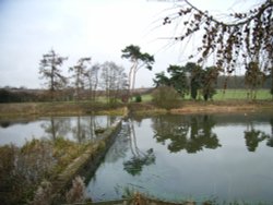
Rutland Water is the largest reservoir in England (by surface area) and one of the largest artificial lakes in Europe. Its.....

image of staunton harold reservoir taken from hall roof, 2003

Staunton Harold Reservoir (5 Pictures)

(17.8 miles, 28.6 km, direction NW)

..

Calke Abbey, Derbyshire

Calke Abbey (57 Pictures)

(18.3 miles, 29.4 km, direction NW)

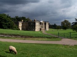
Calke Abbey was built between 1701-1703. The building, in the Baroque style, was built for Sir John Harpur. It is an.....

Twycross Zoo, Leicestershire. Prairie Dog

Twycross Zoo (58 Pictures)

(18.4 miles, 29.7 km, direction W)

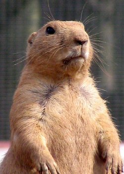
Come face-to-face with over 900 animals of more than 150 species, including some of the most endangered on our planet, at.....

Stanford Hall near Lutterworth, Leicestershire

Stanford Hall (6 Pictures)

(18.4 miles, 29.7 km, direction S)

..

Rockingham Castle Gardens, Corby, Northamptonshire

Rockingham Castle Gardens (3 Pictures)

(18.9 miles, 30.5 km, direction SE)

..

NOTTINGHAM CASTLE MUSEUM

Nottingham Castle Museum (16 Pictures)

(19.1 miles, 30.7 km, direction N)

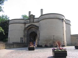
This superb mansion containing Nottingham's museum and art gallery sits on a green and pleasant mound high above the city. It.....


All attractions in Thurmaston
All attractions in Leicestershire