Please login or click here to join.
Forgot Password? Click Here to reset pasword
 |
Winnats Pass Eastern Entrance View The first view as you enter Winnats Pass from the eastern end. This picture appears in the following picture tour: Camera Make: NIKON CORPORATION� Model: NIKON D80� |
 |
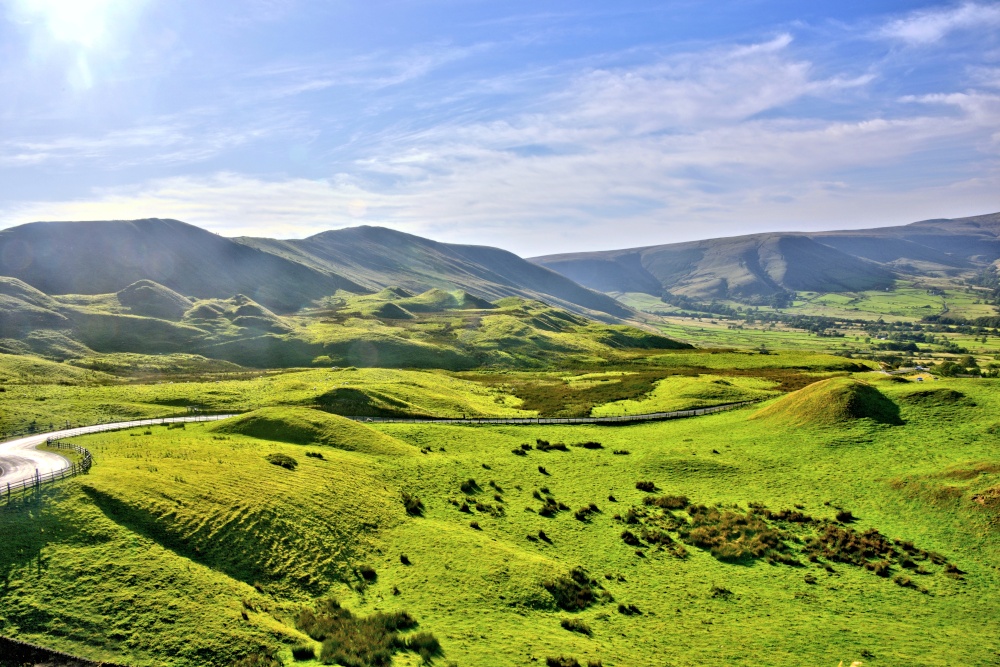
View to Lose Hill from the Top of Winnats Pass The view north from the top of Winnats Pass is Lose Hill, another of the more prominent hills in this part of the Peak District, although not quite as high as Mam Tor. This picture appears in the following picture tours: Camera Make: NIKON CORPORATION� Model: NIKON D80� |
 |
View From Castleton, Northwest Across Barbour Booth (Also Known as the Edale Valley) This view from Castleton is to the northwest, across Barbour Booth, which is also known as the Edale Valley. This picture appears in the following picture tour: |
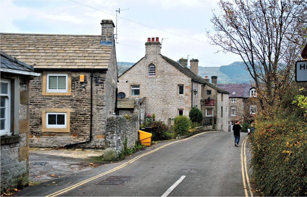 |
View Down Hollowford Road in Castleton, with Typical Stone Cottages & the Ramblers Rest pub A view down Hollowford Road with typical stone cottages and the Ramblers Rest pub. This picture appears in the following picture tour: |
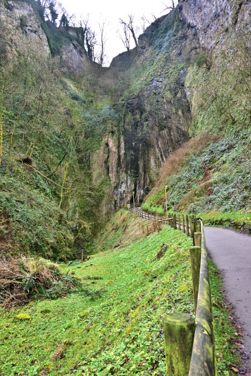 |
The Path From Castleton Centre to Peak Cavern There are several caverns around Castleton, all within easy walking distance, but Peak Cavern is the nearest. Just follow the well surfaced and well signed path alongside Peakshole Water and you're there. This picture appears in the following picture tour: |
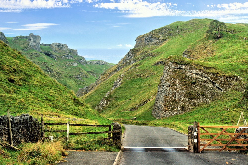 |
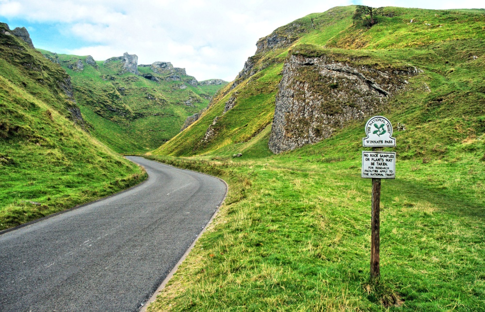
The Eastern Entrance to Winnats Pass Less than a mile from the centre of Castleton, to the west is Winnats Pass, which runs between some of the many large rocky outcrops in this area. These days this gate is often closed to restrict traffic, but parking as available, just out of shot to the right. This picture appears in the following picture tours: |
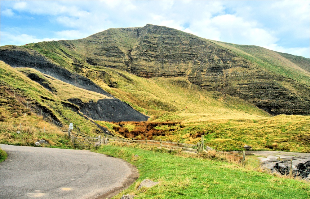 |
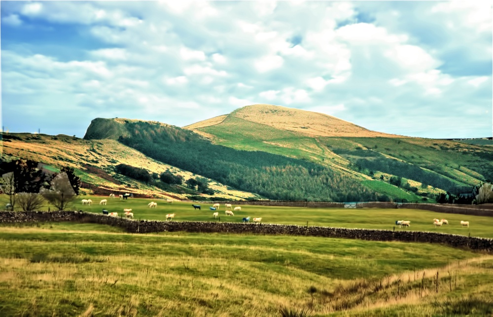
The East Face of Mam Tor near Castleton This is the face of Mam Tor that gives the hill its name, meaning Mother Hill. The lower part of the hill is composed of shale, which splits and cracks, especially in cold weather, causing a series of land slips. Over many years these have created a group of mini or baby hills. On the left of this image, the black areas show that this process has been active recently. This picture appears in the following picture tour: Camera Make: NIKON CORPORATION� Model: NIKON D80� |
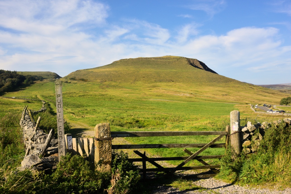 |
Public Footpath to Mam Tor This Gate on the Barbour Booth road is probably the nearest point for a relatively safe and easy walk up Mam Tor. This picture appears in the following picture tour: |
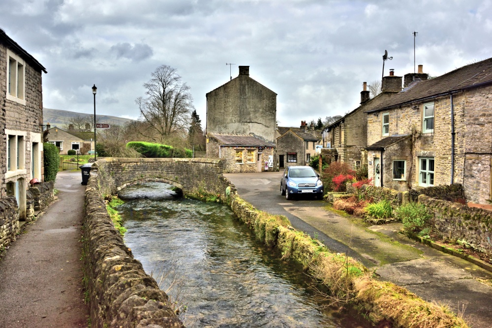 |
Peakshole Water Running Through Castleton Village Here at the foot of Goose Hill, Peakshole Water runs under the stone bridge that carries the street known as The Stones. This picture appears in the following picture tours: |
 |
Peakshole Water Flowing Through Castleton in the Peak District Peakshole Water rises at Peak Cavern and flows north through the centre of Castleton, before turning eastwards to join the River Noe at Hope. The river is well contained by stone walls, paths & roads, etc, as many houses are sited along its banks. This picture appears in the following picture tour: |
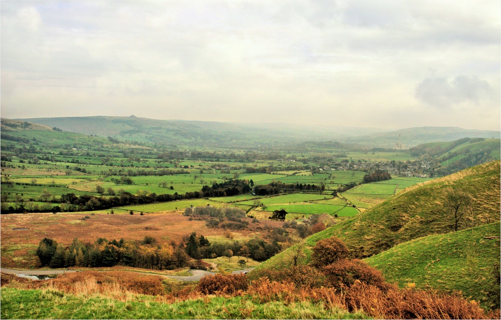 |
Hope Valley View from Castleton in Autumn Looking east from Castleton, along the Hope Valley, with the Breedon Hope Cement Works just visible in the Autumn haze, on the right. This picture appears in the following picture tours: Camera Make: NIKON CORPORATION� Model: NIKON D80� |
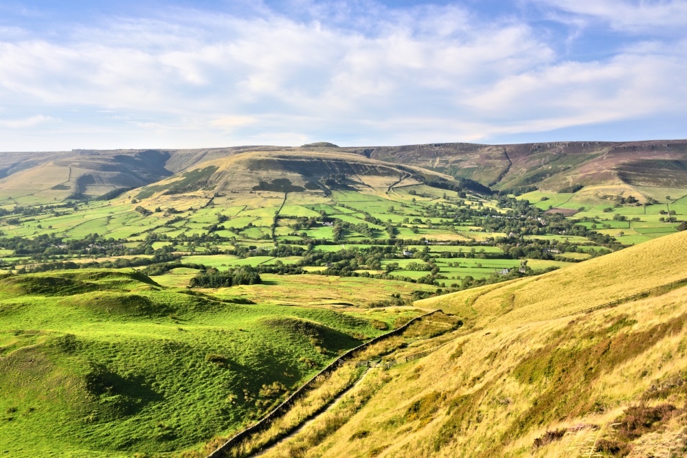 |
Edale Valley Viewed From Castleton This view across the Edale Valley was taken from the side of Mam Tor, to gain a higher point of view. This picture appears in the following picture tours: |
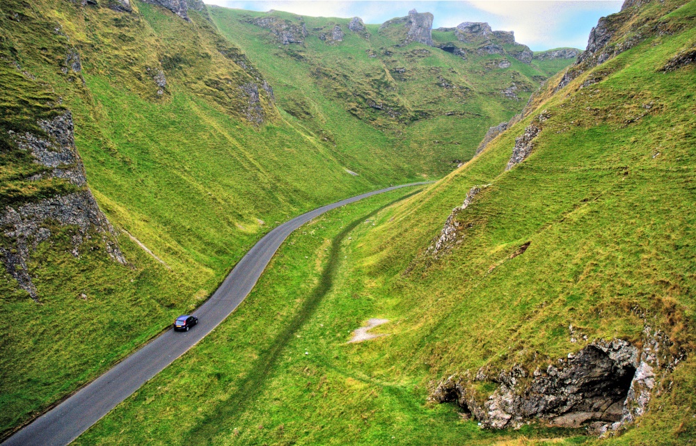 |
Winnats Pass View From the Top of First Cliff Just a few yards in from the eastern entrance of Winnats Pass is a small cliff, with a footpath up the bank to give a great view of the pass. This picture appears in the following picture tour: Camera Make: NIKON CORPORATION� Model: NIKON D80� |
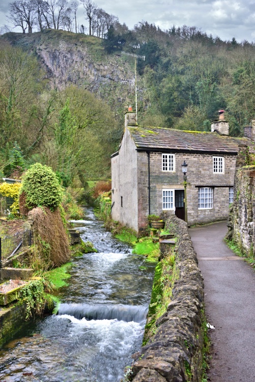 |
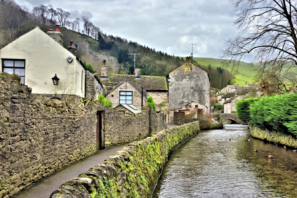
Peakshole Water Flowing Through Castleton with the Cliffs Above Just a few yards after rising at Peak Cavern, Peakshole Water comes into direct contact with houses and roads. The river falling gently in several small steps. This picture appears in the following picture tour: |
Follow PicturesOfEngland.com on social media and help share the beauty of England....