Pictures of England
 Exploring the most Picturesque & Historic parts of England..

Pictures of Mansfield

in the county of Nottinghamshire

Mansfield, Nottinghamshire. A View above tescos.

About Mansfield

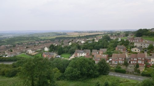
This was once a town of just a few thousand inhabitants in the heart of Sherwood Forest. It developed rapidly into one of the most important industrial centres of the North Midlands following the end of World War II. During the war, both Mansfield and the surrounding region provided sanctuary for Midlander's fleeing the destruction of Hitler's bombs. These were mostly women and children, with girl's being sent to the country areas to work on the land.

However, prior to all of this a community had existed here from the very earliest of times, this was proven by a number of remarkable cliff dwellings discovered in sandstone along the road leading to Southwell. These are known as the Rock Houses, they were lived in right up until the turn of the 20th century. Legacies of Roman occupation have been found in the nearby village of Mansfield Woodhouse, these include coins dating from the time of Vespasian, and the remains of a villa indicate the position of the settlement.

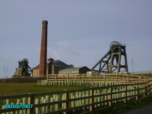
Although there were no collieries in Mansfield, much of its 20th century prosperity came from the surrounding Nottinghamshire coal mines. It also gained stability from the production of hosiery, footwear and lace.

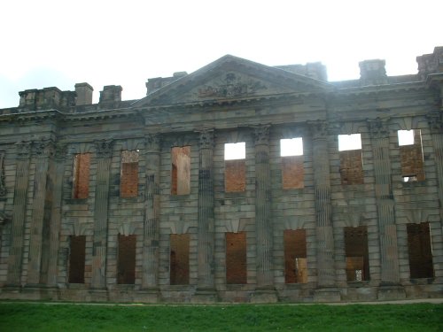
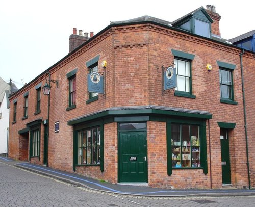
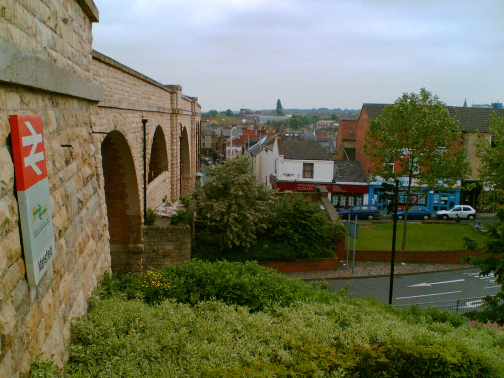
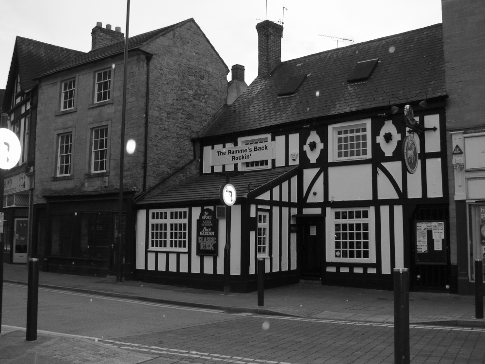
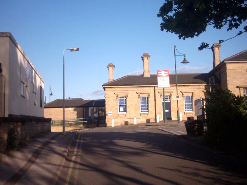
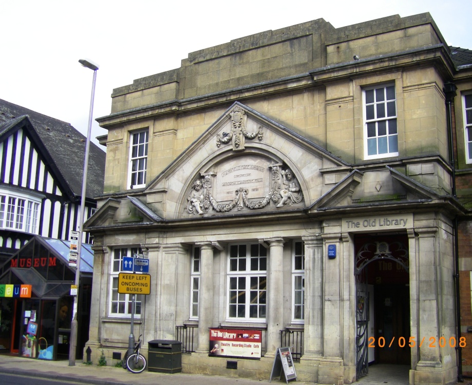
Modern day Mansfield offers visitors a pleasant experience, it has excellent shopping facilities and a range of places catering for leisure. There is a rich mixture of architecture, several modern shop fronts cover buildings of a more gracious age, this is particularly noticeable in Mansfield's lovely old Market Street and in the Market Place which is dominated by a huge memorial to Lord George Frederick Cavendish Bentinck. The market place Moot Hall was given to Mansfield by the Lady of the manor, the Countess of Oxford, of Welbeck Abbey, in 1752. Mansfield's neo-classical Town Hall of 1836 is a Grade II listed building which is about to undergo ambitious repairs and refurbishment. It is proposed that this will provide much needed office space for Mansfield's expanding commercial centre.

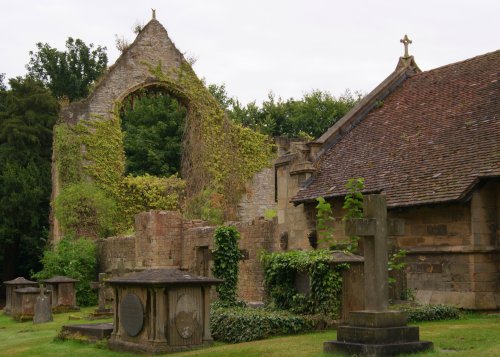
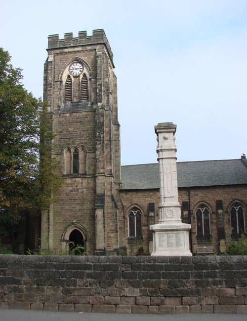
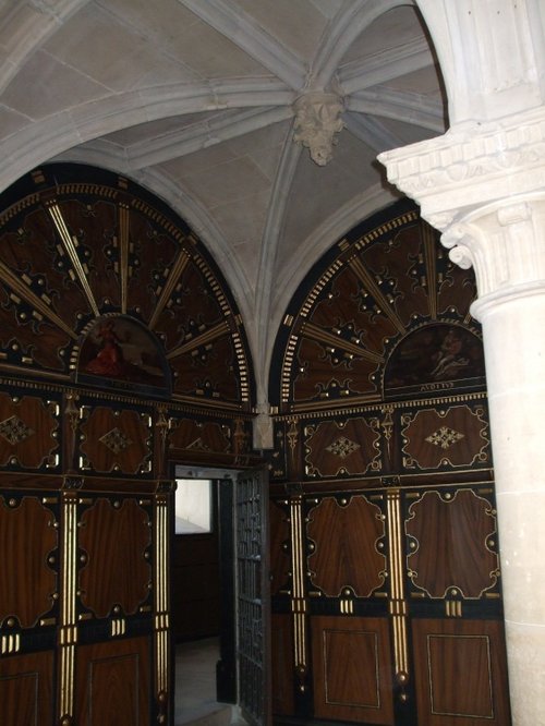
There remain many pre-Victorian buildings to be seen, these include fine Georgian properties in Westgate and the same street possesses the 16th century Cromwell House. The parish church of St.Peter lies a short distance from the Market Place, this has a fine Norman steeple, but is mostly of 14th century build.

A museum in the town centre recalls the history, heritage and folk-lore of Mansfield. However, one anecdote you may not get to hear of is the story of John Cockle, known as the Miller of Mansfield. He is believed to have entertained King Henry II after finding him lost in the woods. He had no idea of the identity of his guest, whom he fed on a huge pasty stuffed with Venison poached from the Royal forest! Fact or fiction, the tale is fun.

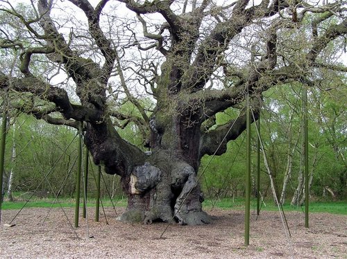
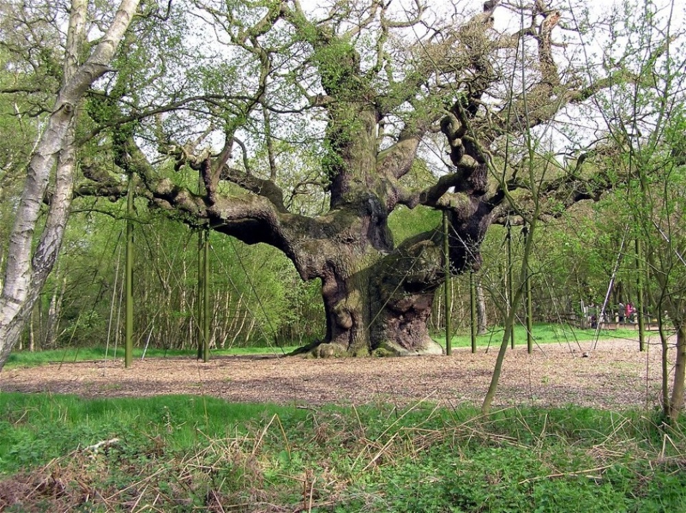
Mansfield gives easy access to the wild beauty of Sherwood Forest with its rich association with the legendry Robin Hood, Maid Marian and Friar Tuck. It is also close to several rivers, these include the Maun, Meden and Poulter, and Southwell racecourse lies within easy driving distance of the town.


Planning a visit? Please see below for other recommended towns, attractions and recommended hotels nearby.

Distances and directions below are approximate. For true driving distances please visit the AA Route Planner

Recommended attractions near Mansfield

King's Mill Reservoir(1.5 miles, 2.3 km, direction SW)Pictures
Pleasley Pit Country Park(3.2 miles, 5.2 km, direction NW)Pictures
Sherwood Pines Forest Park(4.7 miles, 7.5 km, direction E)Pictures
Stainsby Mill(4.8 miles, 7.7 km, direction W)Pictures
Hardwick Hall(4.8 miles, 7.7 km, direction W)Pictures
Newstead Abbey(4.9 miles, 7.9 km, direction S)Pictures
Wonderland Pleasure Park(5.8 miles, 9.3 km, direction SE)Pictures
Poulter Country Park(5.9 miles, 9.5 km, direction N)Pictures
Sherwood Forest(6.0 miles, 9.7 km, direction SE)Pictures
Sherwood Forest Amusement Park(6.4 miles, 10.3 km, direction NE)Pictures
Sherwood Country Park(6.8 miles, 10.9 km, direction NE)Pictures
Rufford Abbey(7.1 miles, 11.5 km, direction E)Pictures
Carr Vale Nature Reserve(7.2 miles, 11.5 km, direction NW)Pictures
Bolsover Castle(7.3 miles, 11.7 km, direction NW)Pictures
Rufford Country Park(7.3 miles, 11.8 km, direction E)Pictures

All attractions in Mansfield
All attractions in Nottinghamshire
Complete A to Z of attractions in England

Recommended towns near Mansfield

Edwinstowe, in the county of Nottinghamshire (6.4 miles, 10.4 km, direction NE)
Info | Pictures | Hotels

Papplewick, in the county of Nottinghamshire (6.6 miles, 10.6 km, direction S)
This delightful village lies close to the forest made famous by the legendry Robin Hood and his sweetheart Maid Marian.
Info | Pictures | Hotels

Bolsover, in the county of Derbyshire (6.9 miles, 11.1 km, direction NW)
Bolsover is a small town lying 5 miles east of Chesterfield. It occupies a picturesque valley setting, watched over by 17th century Bolsover Castle which stands on the site of a former fortress of Norman times.
Info | Pictures | Hotels

Sutton Scarsdale, in the county of Derbyshire (7.6 miles, 12.2 km, direction NW)
This is a village noted for the romantic ruins of what was once one of the grandest houses in Derbyshire.
Info | Pictures | Hotels

Arnold, in the county of Nottinghamshire (10.5 miles, 16.9 km, direction S)
This is an attractive part of Nottingham, at its heart is the splendid church dedicated to St. Mary, a place of worship for over one thousand years.
Info | Pictures | Hotels

Southwell, in the county of Nottinghamshire (11.0 miles, 17.7 km, direction SE)
Southwell, surrounded by lovely open countryside, offers an interesting choice of guest accommodation and has a good range of shops, inns and restaurants.
Info | Pictures | Hotels

Ripley, in the county of Derbyshire (11.0 miles, 17.7 km, direction SW)
Info | Pictures | Hotels

Chesterfield, a Historic Market Town in the county of Derbyshire (11.1 miles, 17.8 km, direction NW)
Chesterfield is an attractive town close to the dramatic peaks of the Peak District National Park. It is well known for its...
Info | Pictures | Hotels

Babbington, in the county of Nottinghamshire (11.4 miles, 18.3 km, direction S)
This pretty Nottinghamshire village is situated around 7 miles from the centre of Nottingham. It is typical of rural England, with cottages interspersed along quiet leafy lanes.
Info | Pictures | Hotels

Worksop, in the county of Nottinghamshire (11.6 miles, 18.7 km, direction N)
The dense spread of Worksop in Nottinghamshire meets with some seriously picturesque countryside, it is fortunate to be ringed by two rivers, the Clumber which borders Clumber Country Park, and the River Ryton.
Info | Pictures | Hotels

Heage, in the county of Derbyshire (12.2 miles, 19.7 km, direction SW)
The village lies a short distance from the beauty spot Carsington Water, between the market town's of Ripley and Belper.
Info | Pictures | Hotels

Crich, in the county of Derbyshire (12.3 miles, 19.9 km, direction W)
A village on the edge of the Peak District National Park with a Museum dedicated solely to the golden era of the Tramcar. Also famous as being the location for filming Peak Practice.
Info | Pictures | Hotels

Denby, in the county of Derbyshire (12.7 miles, 20.4 km, direction SW)
Denby is famous for its beautiful decorative Stoneware pottery which has been exported all over the world.
Info | Pictures | Hotels

Smalley, in the county of Derbyshire (13.1 miles, 21.1 km, direction SW)
A delightful place with attractive village buildings including a church, village hall, several small shops and three village inns.
Info | Pictures | Hotels

Ilkeston, in the county of Derbyshire (13.1 miles, 21.2 km, direction S)
Within this pretty hilltop town you will find the ancient church dedicated to St.Mary, it was built around 1150 and has a beautiful clock-face tower.
Info | Pictures | Hotels

All towns in Nottinghamshire
Complete A to Z of towns in England

Nearby travel help

Mansfield Station(0.4 miles, 0.6 km)
Mansfield Woodhouse Station(1.2 miles, 2.0 km, direction N)
M1 Junction 28(6.0 miles, 9.7 km, direction SW)
M1 Junction 29(6.4 miles, 10.4 km, direction NW)
Sheffield City Airport(18.7 miles, 30.1 km, direction NW)
East Midlands Airport(22.6 miles, 36.3 km, direction S)
Mansfield to London(122.1 miles, 196.4 km, direction SE)

Hotels & Accommodation in Mansfield

Hotel NameApproximate distance from Mansfield center
Clifton Hotel(0.3 miles, 0.5 km)
The Dakota Hotel(5.9 miles, 9.6 km, direction SW)
Twin Oaks Hotel(6.2 miles, 9.9 km, direction NW)
Best Western Bestwood Lodge Hotel(10.0 miles, 16.1 km, direction S)
Van Dyk Hotel(10.0 miles, 16.1 km, direction N)
Batemans Mill(10.1 miles, 16.2 km, direction W)
Clumber Park Hotel LLP(10.8 miles, 17.4 km, direction NE)
Ringwood Hall Hotel(10.8 miles, 17.4 km, direction NW)
Dukeries Park Hotel(11.0 miles, 17.7 km, direction N)
Best Western Lion Hotel(11.1 miles, 17.9 km, direction N)
All hotels in Mansfield

User Login

C.S.Lewis

UK Hotel Search

*Stay in London from just £13 per night!!*

Enter destination:

(town, attraction, airport, postcode or hotel name)
Select date:
Nights:
Rooms:

Picture Tours

More