 |
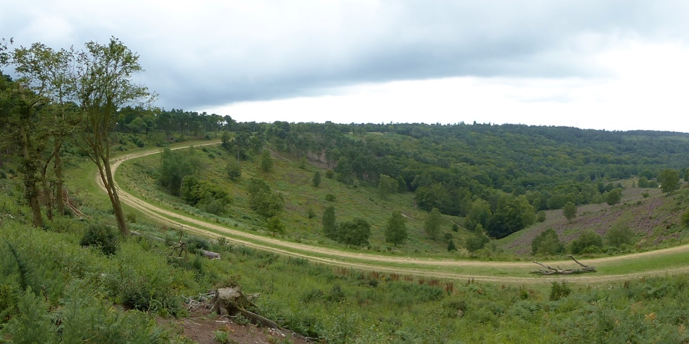
The Lip Of The Bowl What we see here is the edge or lip of the Devil's Punchbowl and the sweeping bend is what is left of the old A3 and I do remember sitting in queues here in the past. Looking over the edge you can see into the bowl and it is a mix of wooded areas and heath type areas with heather growing and in full colour at this point in time. If you take a check on POE pic number 1194724 you can see the the entrance to the longest tunnel of recent construction taking the A3 away from the sensitive area of the Punchbowl allowing nature and wildlife to return where it belongs. Oh and you ask why is it the " Devil's Punchbowl " ? Well it seems the devil was annoyed by the number of churches being built in Sussex so he planned on making lots of channels across the countryside connecting to the English Channel so that they would be flooded. The large tufts of earth he threw up became the hills dotted about the south eg Chanctonbury Ring, but he was thwarted in an area now called "The Devil's Dyke". Legend also says he took great pleasure throwing these giant divots up at the god Thor and the place he scooped out his missiles of earth took the name Devil's Punchbowl and the nearby village to the Punchbowl called Thursley translates as Thor's Place. This picture appears in the following picture tour: Camera Make: Panasonic� Model: DMC-TZ60� |
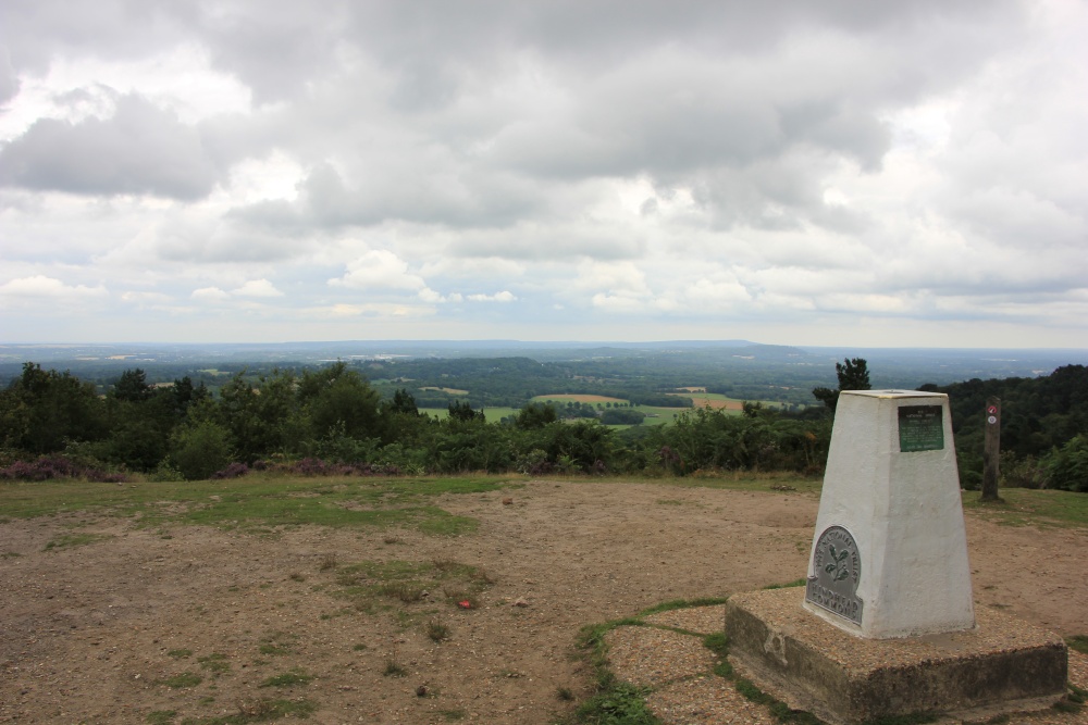 |
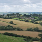
Gibbet Hill Trig Point This is a view from the top of Gibbet Hill looking out to the South East towards the Weald. The Celtic Cross on top of the hill is directly behind me as I take the shot. The Trig pillar is well placed for a commanding view and I would imagine there would be quite a number of target pillars that would have been visible to take reference with large rounds of angles to be taken. One can see by the waymarker that there are a number of walks that can be taken from one on the level and not too long to some demanding long walks with plenty of hills and slopes and varying ground surfaces with sandstone on the higher levels and clay on the lower. This picture appears in the following picture tour: Camera Make: Canon� Model: Canon EOS 550D� |
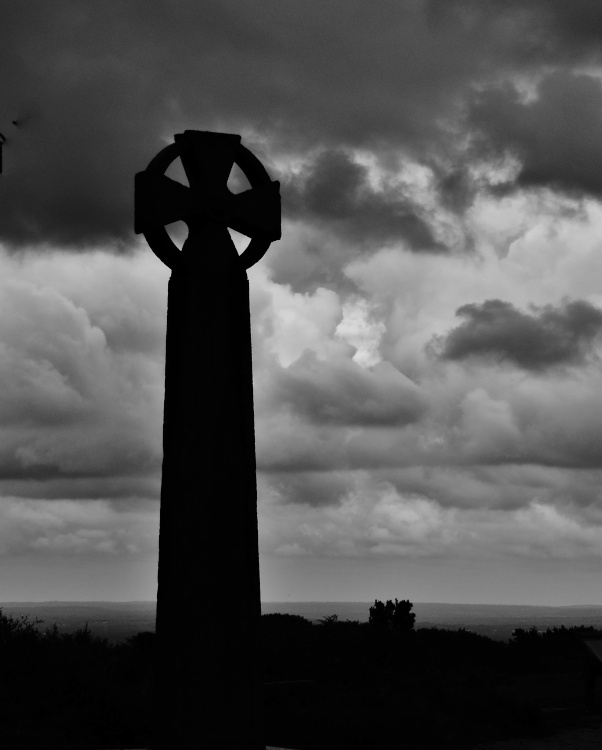 |
The Celtic Cross- Gibbet Hill This is at the summit of Gibbet Hill the second highest point in Surrey at 892 feet, and this is where the three sailors who murdered another sailor who had just been very generous to them. After they had slain the poor sailor he was stripped of all he had including his clothes which they tried to sell in an inn further down the road. They were captured and tried at Kingston Assizes six months later and two days later on the 7th april 1787 they were hung on Gibbet Hill so close to their evil deed. In 1851 Sir William Erie paid for this celtic cross to be put up on the site of the gallows to ward off any evil spirits and to calm the locals. This picture appears in the following picture tour: Camera Make: Panasonic� Model: DMC-TZ60� |
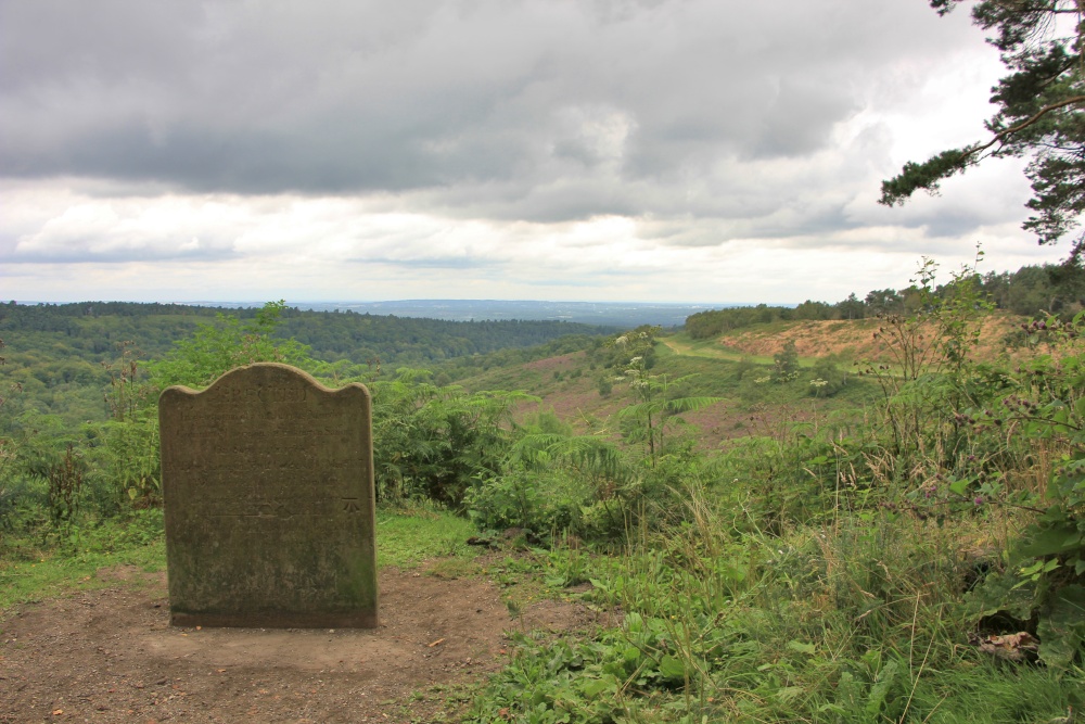 |
The Sailor's Stone This stone overlooking the natural amphitheatre that is The Devil's Punchbowl is a memorial to a sailor who was making his way back to his ship at Portsmouth when he was murdered in 1786. He was killed by three other sailors who had just been the recipients of the generosity of the slain sailor.They were captured and hung on nearby Gibbet Hill. The stone is placed near the old London to Portsmouth road as it passed near the summit of Gibbet Hill and at 892 feet high it is the second highest point in Surrey. The road was at a later time realigned at a lower level but still looking down on the Punchbowl and this is where many a driver sat in traffic queues north of Hindhead on what became the A3 and was the only section of single carriageway between London and Portsmouth- ( but that is another story ) . The one thing I am not happy to see is that the Ordnance Survey have chosen to inscribe a bench mark on the front of the stone in amongst the inscription. This is quite a sensible thing in that anyone who moves the stone is cursed and after being moved once was returned to it's original place. Thus this is a permanent point for a bench mark but I think it could have been put on the side instead- besides there is an OS Trig pillar at the top of the hill. This picture appears in the following picture tour: Camera Make: Canon� Model: Canon EOS 550D� |
Enjoy this site?
Please help us stay online by making a donation today - thank you for your kind support.

Follow PicturesOfEngland.com on social media and help share the beauty of England....