Pictures of Calmore
About Calmore
Lively district within the commuter belt for Southampton which is not quite, but almost, on Southampton Water. It's name in Old English means Cabbage Marshes and it is assumed this bears some reference to it being in close proximity to the River Test. In the 18th-century Seakale was a local "wild-food" delicacy collected from the banks of Southampton Water where it grew in profusion, it was sold to the high class houses and restaurants of London by a local man.
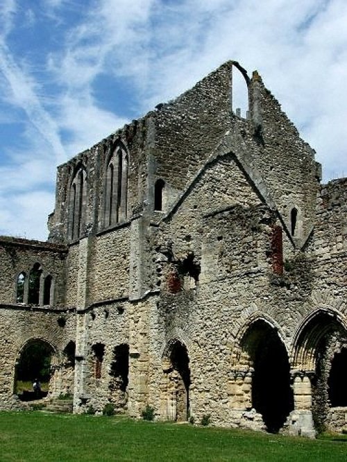
Historically, there is evidence of pre-historic peoples, of the Iron-Age and of the Romans. The area could hardly have been missed by the Saxon's who landed at Southampton Water. Extensive Iron-Age earthworks can still be seen in the area to this day. Hence, we are assured this is an old historic region.
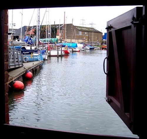
Despite being a short distance inland the village has a tradition of boat building, it has also founded its fortunes on the business of Glove making and Lace making. Vast agricultural lands gave employment to the men of the area for many centuries and does so to this day.
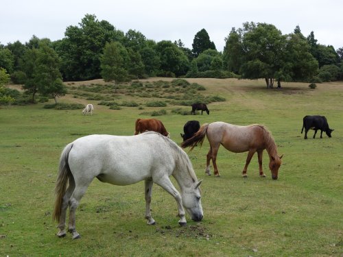
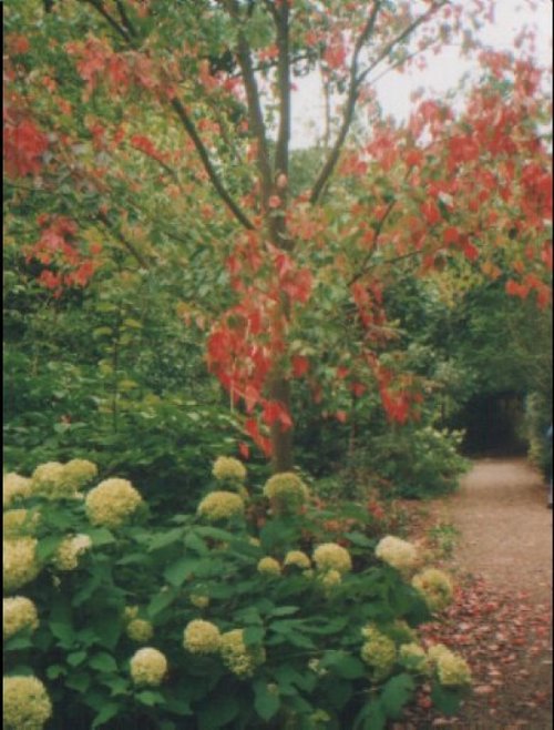
This popular region is surrounded by fine countryside, young ponies can be seen cantering across fields and there are many species of wildlife including deer, badger, squirrel, rabbit and fox. Calmore is adjacent to the mystical New Forest, once hunted by Royalty and now the haunt of wild ponies, many species of birds and other creatures of the wild.
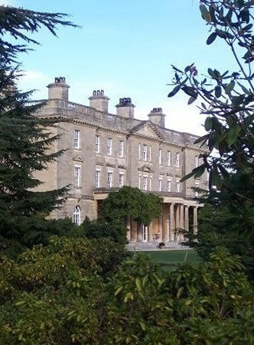
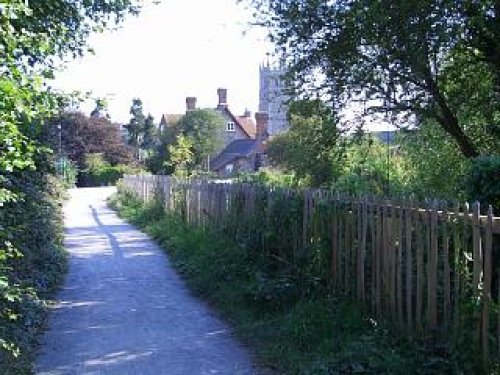
A strong community spirit prevails in Calmore, much of village life is centred around the church dedicated to St. Anne, and the much used local village hall. Interestingly, this happy place has the reputation of being a "haunted village" a cook was murdered at Great Testwood House, Cook's Lane in the village is named for her. She is reputed to haunt the lane on the anniversary of her death and her ghost is believed to appear at Great Testwood House. Many tales surround this house including the fact that one room is bricked up and never used. The house later belonged to William and Humbert the Sherry importers - something in the sherry perhaps!
This is an interesting place, despite its domestic expansion it has managed to retain a pleasant atmosphere and has much rural charm.
Planning a visit? Please see below for other recommended towns, attractions and recommended hotels nearby.
Distances and directions below are approximate. For true driving distances please visit the AA Route Planner
Recommended attractions near Calmore
| Ower Country Park | (2.0 miles, 3.3 km, direction NW) | Pictures |
| Paulton's Park | (2.1 miles, 3.4 km, direction NW) | Pictures |
| Eling Tide Mill | (2.3 miles, 3.7 km, direction SE) | Pictures |
| Longdown Activity Farm | (2.7 miles, 4.4 km, direction S) | Pictures |
| Broadlands | (3.3 miles, 5.3 km, direction N) | Pictures |
| New Forest Otter, Owl and Wildlife Park | (3.7 miles, 5.9 km, direction S) | Pictures |
| Romsey Abbey | (3.9 miles, 6.2 km, direction N) | Pictures |
| King John's House | (4.0 miles, 6.4 km, direction N) | Pictures |
| Bolton's Bench | (4.7 miles, 7.5 km, direction SW) | Pictures |
| Furzy Gardens | (4.9 miles, 7.8 km, direction SW) | Pictures |
| Southampton Maritime Museum | (5.5 miles, 8.8 km, direction SE) | Pictures |
| Tudor Merchants Hall | (5.6 miles, 8.9 km, direction SE) | Pictures |
| Hillier Gardens & Arboretum | (5.9 miles, 9.5 km, direction NE) | Pictures |
| The New Forest | (6.4 miles, 10.3 km, direction SW) | Pictures |
| Itchen Valley Country Park | (7.5 miles, 12.1 km, direction E) | Pictures |
All attractions in CalmoreAll attractions in HampshireComplete A to Z of attractions in EnglandRecommended towns near Calmore
Totton, in the county of Hampshire (1.3 miles, 2.1 km, direction SE)
Totton is a small town lying close to Southampton Water with easy access to the picturesque New Forest National Park, making it a desirable place to stay for anyone wishing to explore both coast and countryside.
Info | Pictures | Hotels
Minstead, in the county of Hampshire (4.2 miles, 6.8 km, direction SW)
This is a delightful New Forest village which was once described as "the place where Mint grew" it is a beautiful unspoilt place with a church which looks as though it is shaped from a collection of cottages.
Info | Pictures | Hotels
Lyndhurst, in the county of Hampshire (5.0 miles, 8.0 km, direction SW)
Info | Pictures | Hotels
Southampton, in the county of Hampshire (5.2 miles, 8.3 km, direction E)
Southampton has many lovely gardens right in the city centre with picnic tables, flower beds and shady walks. In the spring the rhododendrons are a lovely sight.
Info | Pictures | Hotels
Fritham, in the county of Hampshire (6.4 miles, 10.3 km, direction W)
Fritham is an idyllic New Forest village, which was mentioned in the Doomsday Book. It is quite off the beaten track in an area where visitors can enjoy a peaceful atmosphere amongst lovely natural surroundings.
Info | Pictures | Hotels
Netley, in the county of Hampshire (8.2 miles, 13.1 km, direction SE)
Info | Pictures | Hotels
Brockenhurst, in the county of Hampshire (8.3 miles, 13.4 km, direction S)
Gloriously set, like a jewel in a crown, between woodland and heathland, is the picturesque place called Brockenhurst.
Info | Pictures | Hotels
Beaulieu, in the county of Hampshire (8.6 miles, 13.8 km, direction S)
This lovely village is set in the lush greenery of the New Forest where a pretty village street leads to the banks of the Beaulieu River at the point at which it opens up as an estuary.
Info | Pictures | Hotels
Pilley, in the county of Hampshire (10.3 miles, 16.6 km, direction S)
The attractive village of Pilley lies in a landscape famous for its scenic beauty, it encompasses a vast variety of valley's, hills, downs and the glorious New Forest National Park.
Info | Pictures | Hotels
Exbury, in the county of Hampshire (10.4 miles, 16.8 km, direction SE)
Standing close to the saltmarshes and creeks along the Beaulieu River, in an area of outstanding natural beauty, Exbury must be one of the most captivating villages for miles around.
Info | Pictures | Hotels
Boldre, in the county of Hampshire (10.6 miles, 17.1 km, direction S)
This is a beautiful village situated a short distance from the edge of the New Forest National Park and the shoreline of Lymington, in the Solent.
Info | Pictures | Hotels
Downton, in the county of Wiltshire (11.1 miles, 17.8 km, direction W)
It is one of Wiltshire's loveliest villages, with the River Avon forming a division between the ancient village and the new.
Info | Pictures | Hotels
Burley, in the county of Hampshire (11.2 miles, 18.0 km, direction SW)
Info | Pictures | Hotels
Breamore, in the county of Hampshire (11.5 miles, 18.5 km, direction W)
Breamore is one of those beautiful New Forest villages which is populated almost entirely by houses of the Tudor period.
Info | Pictures | Hotels
South Baddesley, in the county of Hampshire (11.5 miles, 18.5 km, direction S)
This is a small picturesque hamlet at the edge of the New Forest National Park overlooking the Solent towards the Isle-of-Wight.
Info | Pictures | Hotels
All towns in HampshireComplete A to Z of towns in EnglandNearby travel help
| M27 Junction 2 | (1.2 miles, 1.9 km, direction NW) |
| Totton Station | (1.6 miles, 2.6 km, direction SE) |
| M271 Junction 1 | (1.9 miles, 3.1 km, direction E) |
| Redbridge Station | (2.4 miles, 3.9 km, direction SE) |
| Southampton Airport | (7.3 miles, 11.7 km, direction E) |
| Bournemouth Airport | (17.3 miles, 27.8 km, direction SW) |
| Calmore to London | (72.3 miles, 116.3 km, direction NE) |
Hotels & Accommodation in Calmore
| Hotel Name | Approximate distance from Calmore center |
| Express By Holiday Inn Southampton West | (2.0 miles, 3.2 km, direction E) |
| The Bartley Lodge Hotel | (2.9 miles, 4.7 km, direction SW) |
| Berties | (3.9 miles, 6.3 km, direction N) |
| Chilworth Manor Classic Hotel | (4.5 miles, 7.2 km, direction NE) |
| Best Western Forest Lodge Hotel | (4.8 miles, 7.7 km, direction SW) |
| The Shoe Inn | (4.8 miles, 7.7 km, direction NW) |
| Novotel Southampton | (4.8 miles, 7.8 km, direction SE) |
| Lyndhurst Park Hotel | (4.9 miles, 7.9 km, direction SW) |
| Banister House Hotel | (5.0 miles, 8.0 km, direction E) |
| Best Western The Crown Hotel | (5.0 miles, 8.0 km, direction SW) |
| All hotels in Calmore |