An attractive small town in the High Peak district of Derbyshire...
Audenshaw is a suburb of Greater Manchester. It is probably best known for its reservoirs and the busy waters of the Ashton canal, beside which visitors can see clusters of delightful canal-side properties...
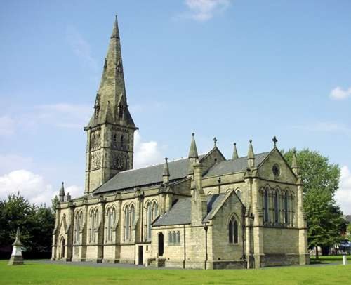
Chapel is a well preserved, picturesque place. It has a lovely old church dating back to the 14th-century which stands on the spot of an earlier church built by foresters a century or so before...
A thriving truly cosmopolitan city with a great mixture of new and old. The capital of the north..
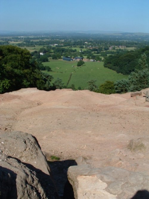
Alderley Edge is a popular tourist spot in the county of Cheshire, consisting of a prominent 'edge' or sandstone ridge which is popular with walkers and offers stunning views. You.....
Set amidst the grandeur of the high Peaks amongst softly rolling countryside of undisputed splendour is the magnificent house.....
..
..
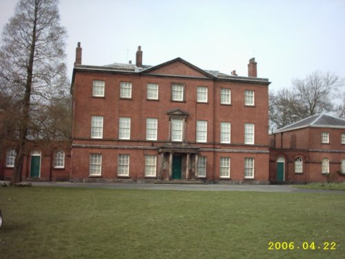
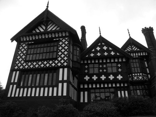
This is a pleasant russet brick house built by Timothy Lightoler in the Mid 18th-century. The interior contains one of the most.....
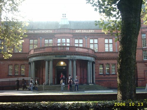
Internationally famous for its collections of art and design, the Whitworth Art Gallery in Manchester, north west England, is.....
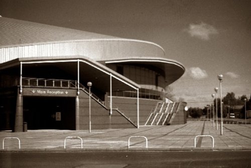
Manchester Velodrome Britains primary indoor Olympic cycle track and widely regarded as one of the world's finest and fastest.....

At restored Quarry Mill the air hangs heavy with the atmosphere of the Victorian people of Wilmslow who spent their days toiling.....
Enjoy this site?
Please help us stay online by making a donation today - thank you for your kind support.

Follow PicturesOfEngland.com on social media and help share the beauty of England....